Waterway information

Kind:
Inland
Driving areas:
🇫🇷 France
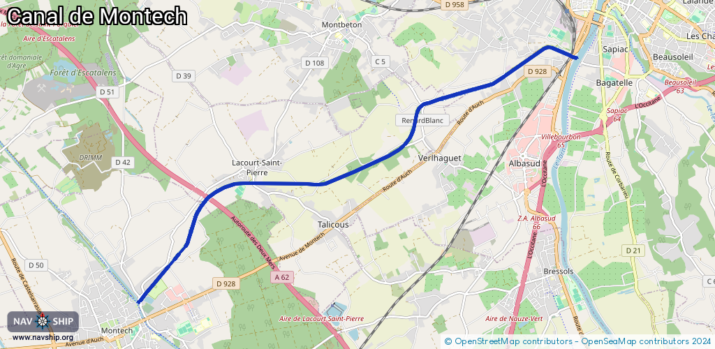
Length:
10.9 km¹
¹River kilometers or bank length recorded in NavShip, including river arms and harbor entrances.
Availability:
Completely recorded
Recent Update: 03.02.2025²
² This date indicates when an adjustment last took place in the course of the body of water
Recorded:
Locks: 11
Harbours / marinas: 0
Bridges: 0
Berths: 0
Slipways: 0
Fuelstations: 0
Route:
Please wait, loading route graphic...
Request waterway overview map with symbol legend here (Link).
Information about data associated with this body of water (11 available):
Data by OpenSeaMap (c) OSM contributors, www.openseamap.org
| # | Kind | Coordinates | Name | Information |
|---|---|---|---|---|
| 1 | Lock | 44.00633,1.34245 | Unknown | |
| 2 | Lock | 44.00651,1.34191 | Unknown | |
| 3 | Lock | 44.00286,1.32568 | Unknown | |
| 4 | Lock | 43.99812,1.30695 | Unknown | |
| 5 | Lock | 43.99606,1.30418 | Unknown | |
| 6 | Lock | 43.99361,1.30335 | Unknown | |
| 7 | Lock | 43.99053,1.30096 | Unknown | |
| 8 | Lock | 43.9888,1.29716 | Unknown | |
| 9 | Lock | 43.98595,1.28858 | Unknown | |
| 10 | Lock | 43.9844,1.28366 | Unknown | |
| 11 | Lock | 43.98376,1.2772 | Unknown |