Waterway information

Kind:
Inland
Driving areas:
🇧🇷 Brazil
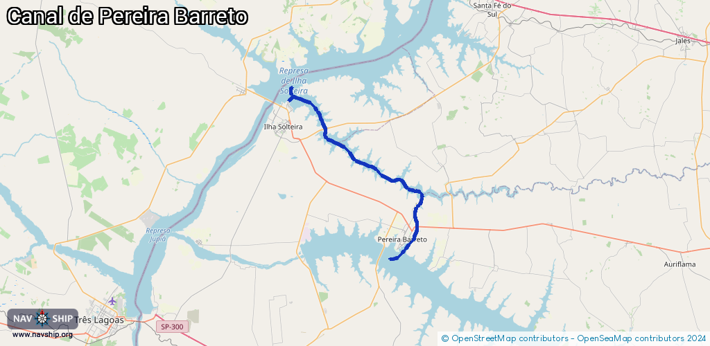
Length:
55.4 km¹
¹River kilometers or bank length recorded in NavShip, including river arms and harbor entrances.
Availability:
Completely recorded
Recent Update: 05.04.2025²
² This date indicates when an adjustment last took place in the course of the body of water
Recorded:
Locks: 0
Harbours / marinas: 0
Bridges: 2
Berths: 2
Slipways: 2
Fuelstations: 0
Route:
Please wait, loading route graphic...
Request waterway overview map with symbol legend here (Link).
Information about data associated with this body of water (6 available):
Data by OpenSeaMap (c) OSM contributors, www.openseamap.org
| # | Kind | Coordinates | Name | Information |
|---|---|---|---|---|
| 1 | Bridge | -20.43283,-51.2587 | Unknown | Clearance height: 2013-06-23T15:09:51Z m Maximum passage width: 9 m fixed |
| 2 | Bridge | -20.61406,-51.0766 | Unknown | Clearance height: 2013-06-23T15:16:20Z m Maximum passage width: 14.3 m fixed |
| 3 | Slipway | -20.37927,-51.33195 | small_craft_facility | 2020-04-02T16:16:12Z |
| 4 | Slipway | -20.53913,-51.0913 | small_craft_facility | 2013-11-16T09:48:25Z |
| 5 | Berth | -20.38025,-51.33034 | 2014-06-03T01:19:42Z | |
| 6 | Berth | -20.65915,-51.11968 | 2014-06-03T01:29:06Z | Tablado |