Waterway information

Kind:
Inland
Driving areas:
🇫🇷 France
Length:
12.9 km¹
¹River kilometers or bank length recorded in NavShip, including river arms and harbor entrances.
Availability:
Completely recorded
Recent Update: 19.06.2023²
² This date indicates when an adjustment last took place in the course of the body of water
Recorded:
Locks: 8
Harbours / marinas: 4
Bridges: 1
Berths: 0
Slipways: 0
Fuelstations: 0
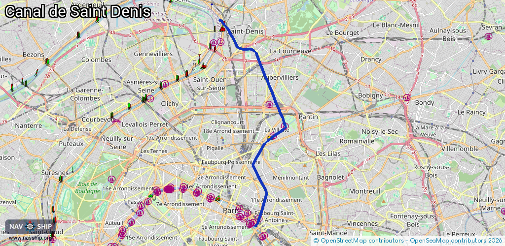
Route:
Please wait, loading route graphic...
Request waterway overview map with symbol legend here (Link).
Information about data associated with this body of water (9 available):
Data by OpenSeaMap (c) OSM contributors, www.openseamap.org
| # | Kind | Coordinates | Name | Information |
|---|---|---|---|---|
| 1 | Marina | 48.84902,2.36722 | 2024-02-20T09:17:26Z | Port de l'Arsenal http://www.fayollemarine.fr |
| 2 | Marina | 48.88761,2.37745 | 2025-09-09T18:29:42Z | Halte nautique de la Villette |
| 3 | Marina | 48.89207,2.38559 | 2024-08-08T07:19:15Z | Demoiselle |
| 4 | Marina | 48.90204,2.3749 | 2022-08-16T19:53:11Z | Electric boat |
| 5 | Bridge | 48.94053,2.3413 | Unknown | Clearance height: 2021-03-05T13:51:46Z m Movable bridge (e.g. lifting bridge or drawbridge) fixed |
| 6 | Lock | 48.84691,2.36576 | Unknown | |
| 7 | Lock | 48.88347,2.37077 | Unknown | |
| 7 | Lock | 48.88347,2.37077 | Unknown | |
| 7 | Lock | 48.88347,2.37077 | Unknown | |
| 7 | Lock | 48.88347,2.37077 | Unknown | |
| 8 | Lock | 48.92751,2.35751 | Unknown | |
| 8 | Lock | 48.92751,2.35751 | Unknown | |
| 9 | Lock | 48.94018,2.34193 | Unknown |