Waterway information

Kind:
Inland
Driving areas:
🇫🇷 France
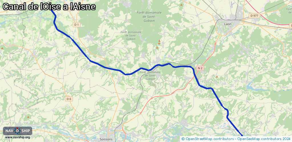
Length:
47.7 km¹
¹River kilometers or bank length recorded in NavShip, including river arms and harbor entrances.
Availability:
Completely recorded
Recent Update: 18.11.2021²
² This date indicates when an adjustment last took place in the course of the body of water
Recorded:
Locks: 12
Harbours / marinas: 1
Bridges: 0
Berths: 0
Slipways: 0
Fuelstations: 0
Route:
Please wait, loading route graphic...
Request waterway overview map with symbol legend here (Link).
Information about data associated with this body of water (13 available):
Data by OpenSeaMap (c) OSM contributors, www.openseamap.org
| # | Kind | Coordinates | Name | Information |
|---|---|---|---|---|
| 1 | Marina | 49.38881,3.65549 | 2022-11-13T15:57:44Z | Halte nautique de Bourg et Comin |
| 2 | Lock | 49.5914,3.19113 | Unknown | |
| 3 | Lock | 49.51379,3.27991 | Unknown | |
| 4 | Lock | 49.50112,3.31032 | Unknown | |
| 5 | Lock | 49.49326,3.34832 | Unknown | |
| 6 | Lock | 49.49459,3.40909 | Unknown | |
| 7 | Lock | 49.49963,3.45966 | Unknown | |
| 8 | Lock | 49.49818,3.52541 | Unknown | |
| 9 | Lock | 49.48003,3.54386 | Unknown | |
| 10 | Lock | 49.46921,3.55135 | Unknown | |
| 11 | Lock | 49.42593,3.62066 | Unknown | |
| 12 | Lock | 49.42034,3.61918 | Unknown | |
| 13 | Lock | 49.41521,3.62186 | Unknown |