Waterway information

Kind:
Inland
Driving areas:
🇫🇷 France🌊 North Sea
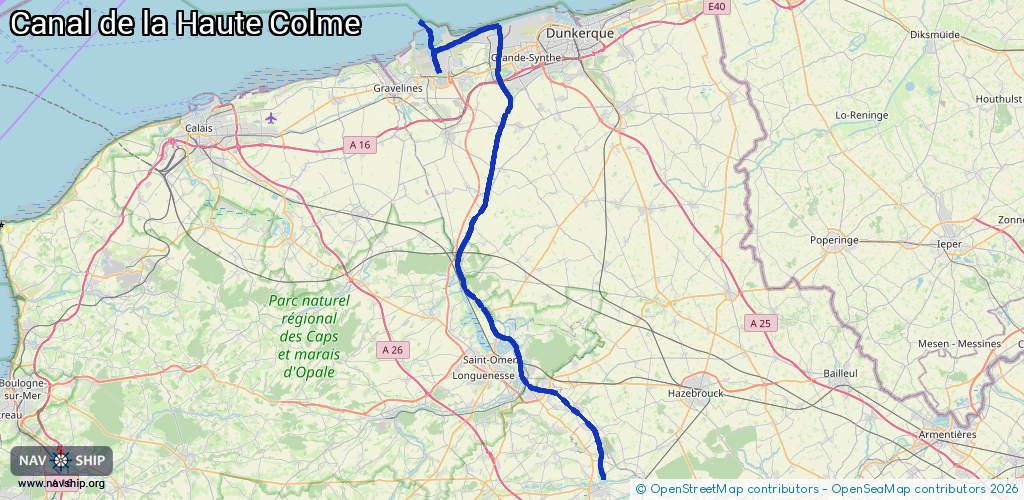
Length:
64 km¹
¹River kilometers or bank length recorded in NavShip, including river arms and harbor entrances.
Availability:
Completely recorded
Recent Update: 04.04.2025²
² This date indicates when an adjustment last took place in the course of the body of water
Recorded:
Locks: 4
Harbours / marinas: 7
Bridges: 0
Berths: 0
Slipways: 0
Fuelstations: 0
Route:
Please wait, loading route graphic...
Request waterway overview map with symbol legend here (Link).
Information about data associated with this body of water (11 available):
Data by OpenSeaMap (c) OSM contributors, www.openseamap.org
| # | Kind | Coordinates | Name | Information |
|---|---|---|---|---|
| 1 | Marina | 50.74645,2.29788 | 2022-02-06T20:48:00Z | Port Fluvial |
| 2 | Marina | 51.03584,2.26179 | 2025-11-24T12:23:46Z | Bassin Maritime de Mardyck |
| 3 | Marina | 51.0383,2.26389 | 2025-11-24T12:23:46Z | Bassin Maritime de Mardyck |
| 4 | Marina | 51.04175,2.26016 | 2022-02-06T20:54:23Z | Port de Dunkerque +33 3 28 28 76 95 http://www.dunkerque-port.fr/ |
| 5 | Marina | 51.04091,2.16251 | 2013-11-18T07:13:46Z | Port Ouest de Dunkerque |
| 6 | Marina | 51.01057,2.18454 | 2021-01-03T00:45:46Z | |
| 7 | Marina | 51.01214,2.17676 | 2015-01-28T09:44:43Z | Bassin de l'Atlantique |
| 8 | Lock | 50.72851,2.30741 | Unknown | |
| 9 | Lock | 50.74353,2.29488 | Unknown | |
| 10 | Lock | 50.8413,2.20978 | Unknown | |
| 11 | Lock | 51.04008,2.25542 | Unknown |