Waterway information

Kind:
Inland
Driving areas:
🇫🇷 France
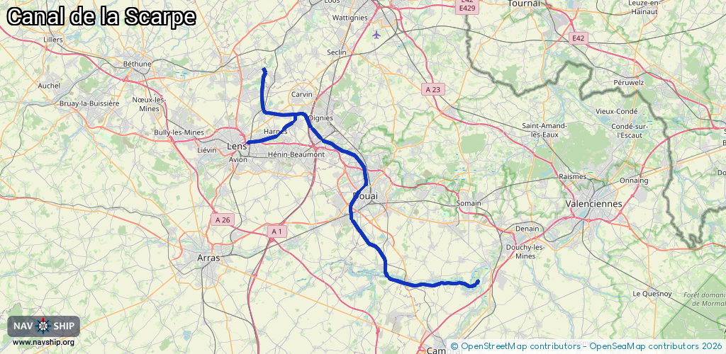
Length:
62.6 km¹
¹River kilometers or bank length recorded in NavShip, including river arms and harbor entrances.
Availability:
Completely recorded
Recent Update: 08.08.2023²
² This date indicates when an adjustment last took place in the course of the body of water
Recorded:
Locks: 3
Harbours / marinas: 1
Bridges: 0
Berths: 0
Slipways: 0
Fuelstations: 0
Route:
Please wait, loading route graphic...
Request waterway overview map with symbol legend here (Link).
Information about data associated with this body of water (4 available):
Data by OpenSeaMap (c) OSM contributors, www.openseamap.org
| # | Kind | Coordinates | Name | Information |
|---|---|---|---|---|
| 1 | Marina | 50.39352,3.07981 | 2013-08-15T07:53:35Z | Gare d'eau de Dorignies |
| 2 | Lock | 50.31499,3.0801 | Unknown | |
| 3 | Lock | 50.34238,3.05255 | Unknown | |
| 4 | Lock | 50.37617,3.07212 | Unknown |