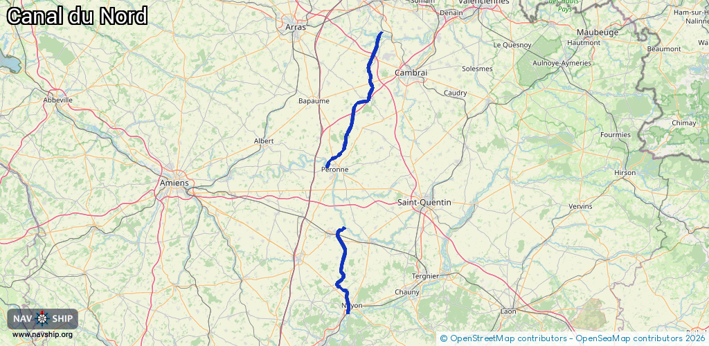
Waterway information

Kind:
Inland
Driving areas:
🇫🇷 France
Length:
75 km¹
¹River kilometers or bank length recorded in NavShip, including river arms and harbor entrances.
Availability:
Completely recorded
Recent Update: 18.08.2025²
² This date indicates when an adjustment last took place in the course of the body of water
Recorded:
Locks: 17
Harbours / marinas: 0
Bridges: 0
Berths: 0
Slipways: 0
Fuelstations: 0
Route:
Please wait, loading route graphic...
Request waterway overview map with symbol legend here (Link).
Information about data associated with this body of water (17 available):
Data by OpenSeaMap (c) OSM contributors, www.openseamap.org
| # | Kind | Coordinates | Name | Information |
|---|---|---|---|---|
| 1 | Lock | 49.98146,2.96753 | Unknown | |
| 2 | Lock | 49.97365,2.95848 | Unknown | |
| 3 | Lock | 49.96725,2.94852 | Unknown | |
| 4 | Lock | 49.95599,2.92101 | Unknown | |
| 5 | Lock | 49.94466,2.90479 | Unknown | |
| 6 | Lock | 50.26794,3.10538 | Unknown | |
| 7 | Lock | 50.21126,3.07701 | Unknown | |
| 8 | Lock | 50.18848,3.06422 | Unknown | |
| 9 | Lock | 50.17483,3.06813 | Unknown | |
| 10 | Lock | 50.15984,3.07177 | Unknown | |
| 11 | Lock | 50.14519,3.07602 | Unknown | |
| 12 | Lock | 50.13072,3.07679 | Unknown | |
| 13 | Lock | 49.75603,2.94547 | Unknown | |
| 14 | Lock | 49.65245,2.96427 | Unknown | |
| 15 | Lock | 49.61876,2.96886 | Unknown | |
| 16 | Lock | 49.5744,2.98551 | Unknown | |
| 17 | Lock | 49.56563,2.98388 | Unknown |