Waterway information

Kind:
Inland
Driving areas:
🇮🇹 Italy🌊 Sea Mediterranean
Length:
27.2 km¹
¹River kilometers or bank length recorded in NavShip, including river arms and harbor entrances.
Availability:
Completely recorded
Recent Update: 02.09.2025²
² This date indicates when an adjustment last took place in the course of the body of water
Recorded:
Locks: 0
Harbours / marinas: 3
Bridges: 0
Berths: 0
Slipways: 1
Fuelstations: 1
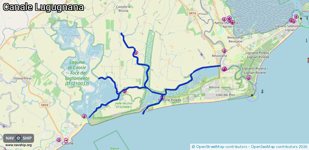
Route:
Please wait, loading route graphic...
Request waterway overview map with symbol legend here (Link).
Information about data associated with this body of water (5 available):
Data by OpenSeaMap (c) OSM contributors, www.openseamap.org
| # | Kind | Coordinates | Name | Information |
|---|---|---|---|---|
| 1 | Marina | 45.63956,12.95247 | 2025-06-17T22:51:58Z | |
| 2 | Marina | 45.63446,12.99604 | 2025-10-10T19:55:05Z | Marina Resort Porto Baseleghe +39 0431 43686 https://www.portobaseleghe.com/index.aspx |
| 3 | Marina | 45.67035,12.96525 | 2025-08-19T19:52:04Z | |
| 4 | Slipway | 45.63908,12.94781 | small_craft_facility | 2016-03-15T00:40:37Z by car |
| 5 | Fuel station | 45.63452,12.99634 | 2024-09-26T22:28:45Z |