Waterway information

Kind:
Sea
Driving areas:
🇮🇹 Italy🌊 Sea Mediterranean
Length:
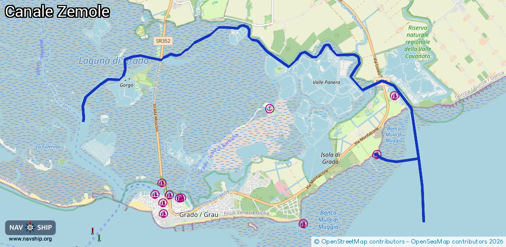
17.2 km¹
¹River kilometers or bank length recorded in NavShip, including river arms and harbor entrances.
Availability:
Completely recorded
Recent Update: 08.05.2025²
² This date indicates when an adjustment last took place in the course of the body of water
Recorded:
Locks: 0
Harbours / marinas: 2
Bridges: 0
Berths: 0
Slipways: 3
Fuelstations: 0
Route:
Please wait, loading route graphic...
Request waterway overview map with symbol legend here (Link).
Information about data associated with this body of water (5 available):
Data by OpenSeaMap (c) OSM contributors, www.openseamap.org
| # | Kind | Coordinates | Name | Information |
|---|---|---|---|---|
| 1 | Marina | 45.69269,13.45961 | 2021-07-10T09:48:06Z | Camping Village Europa |
| 2 | Marina | 45.70674,13.46577 | 2023-11-10T22:22:33Z | Marina Tenuta Primero [email protected] +39 0431 896900 https://www.tenuta-primero.com/sito/page/content/menu/195 |
| 3 | Slipway | 45.70895,13.46376 | small_craft_facility | 2018-10-27T11:59:44Z |
| 4 | Slipway | 45.70453,13.46818 | Unknown | 2014-10-10T18:26:23Z |
| 5 | Slipway | 45.70451,13.46814 | small_craft_facility | 2022-12-27T17:06:30Z |