Waterway information

Kind:
Inland
Driving areas:
🇺🇸 United States of America
Length:
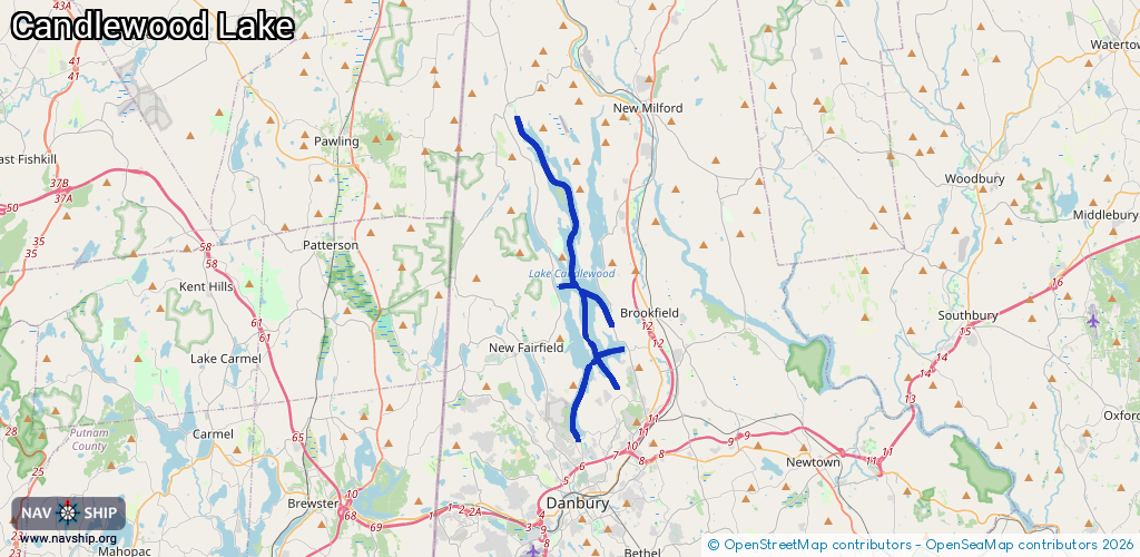
25.4 km¹
¹River kilometers or bank length recorded in NavShip, including river arms and harbor entrances.
Availability:
Completely recorded
Recent Update: 13.02.2024²
² This date indicates when an adjustment last took place in the course of the body of water
Recorded:
Locks: 0
Harbours / marinas: 5
Bridges: 0
Berths: 0
Slipways: 0
Fuelstations: 0
Route:
Please wait, loading route graphic...
Request waterway overview map with symbol legend here (Link).
Information about data associated with this body of water (5 available):
Data by OpenSeaMap (c) OSM contributors, www.openseamap.org
| # | Kind | Coordinates | Name | Information |
|---|---|---|---|---|
| 1 | Marina | 41.57306,-73.49181 | 2021-10-19T19:47:16Z | |
| 2 | Marina | 41.42458,-73.45396 | 2025-09-23T14:49:04Z | Danbury Yacht Club |
| 3 | Marina | 41.48318,-73.43526 | 2023-11-12T17:13:54Z | |
| 4 | Marina | 41.46612,-73.42242 | 2025-12-05T04:29:17Z | Candlewood East Marina +1-203-775-2253 https://www.candlewoodeast.com/ |
| 5 | Marina | 41.49557,-73.4653 | 2023-11-12T17:13:54Z |