Waterway information

Kind:
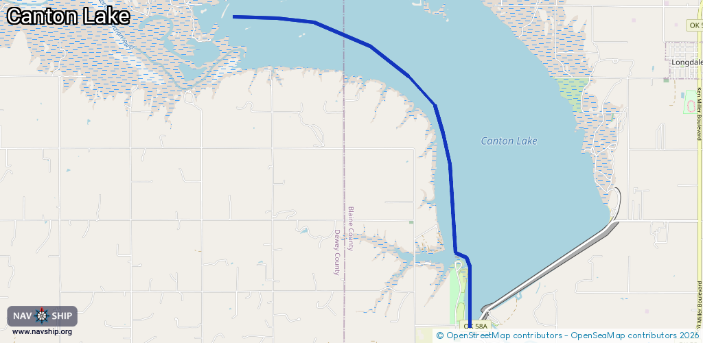
Inland
Driving areas:
🇺🇸 United States of America
Length:
10.4 km¹
¹River kilometers or bank length recorded in NavShip, including river arms and harbor entrances.
Availability:
Completely recorded
Recent Update: 01.04.2025²
² This date indicates when an adjustment last took place in the course of the body of water
Recorded:
Locks: 0
Harbours / marinas: 0
Bridges: 0
Berths: 0
Slipways: 8
Fuelstations: 0
Route:
Please wait, loading route graphic...
Request waterway overview map with symbol legend here (Link).
Information about data associated with this body of water (8 available):
Data by OpenSeaMap (c) OSM contributors, www.openseamap.org
| # | Kind | Coordinates | Name | Information |
|---|---|---|---|---|
| 1 | Slipway | 36.09177,-98.6059 | Unknown | 2022-10-06T21:19:03Z |
| 2 | Slipway | 36.09165,-98.60594 | shoreline_construction | 2020-07-12T17:14:21Z |
| 3 | Slipway | 36.09304,-98.60887 | Unknown | 2023-04-14T14:00:19Z |
| 4 | Slipway | 36.09297,-98.60882 | shoreline_construction | 2020-07-12T17:14:21Z |
| 5 | Slipway | 36.11178,-98.61358 | Unknown | 2022-10-06T21:19:03Z |
| 6 | Slipway | 36.11178,-98.61376 | shoreline_construction | 2020-07-16T22:11:12Z |
| 7 | Slipway | 36.11786,-98.61367 | Unknown | 2022-10-06T21:19:03Z |
| 8 | Slipway | 36.11788,-98.61375 | shoreline_construction | 2020-07-16T22:11:12Z |