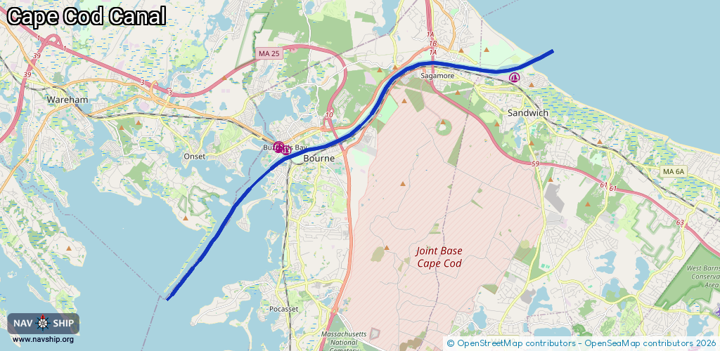
Waterway information

Kind:
Inland
Driving areas:
🌊 Atlantic Ocean🇺🇸 United States of America
Length:
20.1 km¹
¹River kilometers or bank length recorded in NavShip, including river arms and harbor entrances.
Availability:
Completely recorded
Recent Update: 15.04.2025²
² This date indicates when an adjustment last took place in the course of the body of water
Recorded:
Locks: 0
Harbours / marinas: 4
Bridges: 0
Berths: 0
Slipways: 0
Fuelstations: 0
Route:
Please wait, loading route graphic...
Request waterway overview map with symbol legend here (Link).
Information about data associated with this body of water (4 available):
Data by OpenSeaMap (c) OSM contributors, www.openseamap.org
| # | Kind | Coordinates | Name | Information |
|---|---|---|---|---|
| 1 | Marina | 41.77051,-70.5036 | 2021-08-17T15:19:06Z | Sandwich Marina https://sandwichmarina.com/ |
| 2 | Marina | 41.74422,-70.61503 | 2023-05-03T14:54:40Z | Cape Cod Canal Access |
| 3 | Marina | 41.74557,-70.61869 | 2022-07-13T17:32:56Z | Cape Cod Canal Access |
| 4 | Marina | 41.74493,-70.61894 | 2022-07-13T17:32:56Z | Bourne Marina |