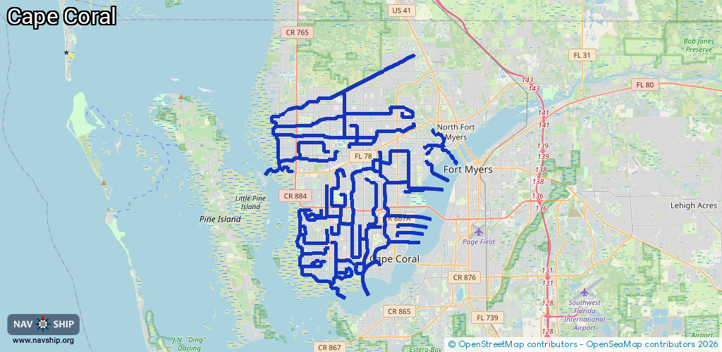
Waterway information

Kind:
Inland
Driving areas:
🌊 Atlantic Ocean🇺🇸 United States of America
Length:
229.7 km¹
¹River kilometers or bank length recorded in NavShip, including river arms and harbor entrances.
Availability:
Completely recorded
Recent Update: 08.08.2025²
² This date indicates when an adjustment last took place in the course of the body of water
Recorded:
Locks: 1
Harbours / marinas: 3
Bridges: 0
Berths: 0
Slipways: 0
Fuelstations: 0
Route:
Please wait, loading route graphic...
Request waterway overview map with symbol legend here (Link).
Information about data associated with this body of water (4 available):
Data by OpenSeaMap (c) OSM contributors, www.openseamap.org
| # | Kind | Coordinates | Name | Information |
|---|---|---|---|---|
| 1 | Marina | 26.53918,-81.9999 | 2022-08-27T22:09:41Z | Tarpon Point Marina |
| 2 | Marina | 26.63884,-81.90803 | 2025-11-30T01:15:02Z | |
| 3 | Marina | 26.62812,-81.91729 | 2024-05-29T18:35:23Z | Paradise Marina |
| 4 | Lock | 26.54338,-82.00906 | Unknown |