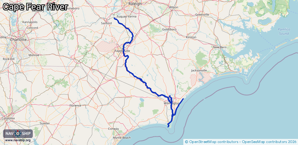
Waterway information

Kind:
Inland
Driving areas:
🌊 Atlantic Ocean🇺🇸 United States of America
Length:
369.3 km¹
¹River kilometers or bank length recorded in NavShip, including river arms and harbor entrances.
Availability:
Completely recorded
Recent Update: 04.04.2025²
² This date indicates when an adjustment last took place in the course of the body of water
Recorded:
Locks: 3
Harbours / marinas: 8
Bridges: 0
Berths: 0
Slipways: 1
Fuelstations: 0
Route:
Please wait, loading route graphic...
Request waterway overview map with symbol legend here (Link).
Information about data associated with this body of water (12 available):
Data by OpenSeaMap (c) OSM contributors, www.openseamap.org
| # | Kind | Coordinates | Name | Information |
|---|---|---|---|---|
| 1 | Marina | 34.07801,-77.88764 | 2022-09-02T22:11:32Z | |
| 2 | Marina | 34.08885,-77.88166 | 2022-09-02T22:17:06Z | |
| 3 | Marina | 34.08579,-77.88297 | 2022-09-02T22:13:44Z | |
| 4 | Marina | 34.0501,-77.91931 | 2023-10-02T10:51:01Z | |
| 5 | Marina | 34.13792,-77.86789 | 2025-02-17T16:39:01Z | Helms Port Marina |
| 6 | Marina | 34.31277,-77.95372 | 2021-12-31T19:50:27Z | |
| 7 | Marina | 33.93065,-77.99941 | 2020-05-19T23:13:45Z | Deep Point Marina |
| 8 | Marina | 33.87655,-77.99994 | 2026-01-12T18:11:01Z | Bald Head Island Marina [email protected] +1 910 457 7380 https://www.baldheadisland.com/see-do/marinas/bald-head-island-marina |
| 9 | Slipway | 35.5507,-79.02459 | small_craft_facility | 2015-10-14T10:21:18Z Wrc Avents Ferry Bridge Access Area |
| 10 | Lock | 34.83482,-78.82333 | US Lock and Dam | |
| 11 | Lock | 34.62638,-78.57728 | Lock and Dam | |
| 12 | Lock | 34.40421,-78.29358 | Lock and Dam |