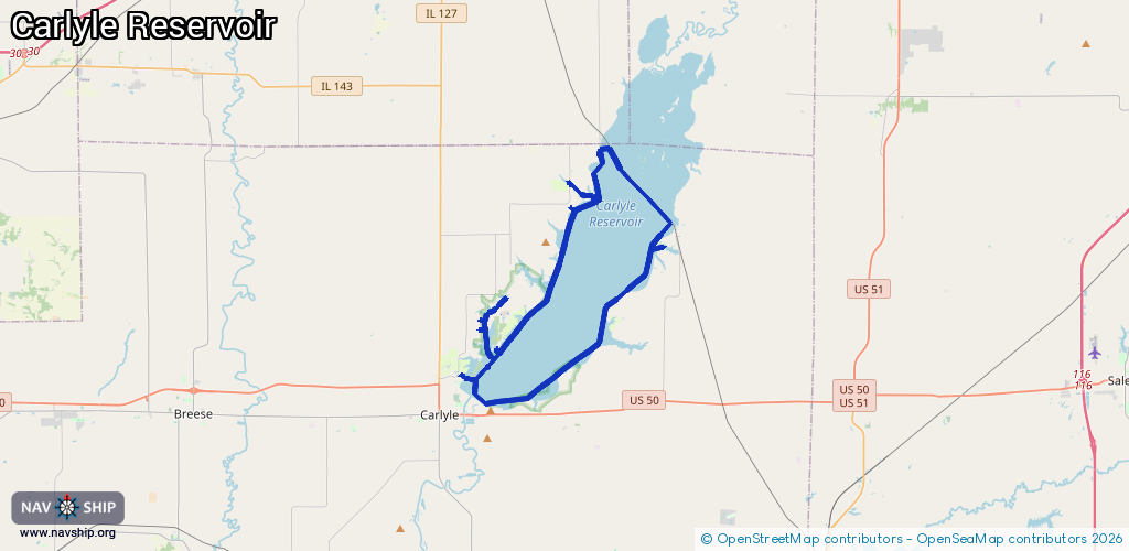
Waterway information

Kind:
Lake
Driving areas:
🇺🇸 United States of America
Length:
47.2 km¹
¹River kilometers or bank length recorded in NavShip, including river arms and harbor entrances.
Availability:
Completely recorded
Recent Update: 01.04.2025²
² This date indicates when an adjustment last took place in the course of the body of water
Recorded:
Locks: 0
Harbours / marinas: 7
Bridges: 0
Berths: 0
Slipways: 0
Fuelstations: 0
Route:
Please wait, loading route graphic...
Request waterway overview map with symbol legend here (Link).
Information about data associated with this body of water (7 available):
Data by OpenSeaMap (c) OSM contributors, www.openseamap.org
| # | Kind | Coordinates | Name | Information |
|---|---|---|---|---|
| 1 | Marina | 38.69285,-89.23319 | 2020-09-21T01:38:15Z | |
| 2 | Marina | 38.65151,-89.34772 | 2022-10-30T22:04:33Z | |
| 3 | Marina | 38.73837,-89.27322 | 2020-08-26T02:07:24Z | |
| 4 | Marina | 38.72389,-89.29283 | 2020-09-21T01:38:15Z | |
| 5 | Marina | 38.71065,-89.29064 | 2020-09-21T01:38:15Z | |
| 6 | Marina | 38.65631,-89.34745 | 2022-10-30T22:04:33Z | |
| 7 | Marina | 38.64269,-89.33718 | 2024-07-01T12:34:28Z | Carlyle Sailing Association +1-618-594-3622 https://csa-sailing.org/Welcome_to_CSA.html |