Waterway information

Kind:
Inland
Driving areas:
🇺🇸 United States of America
Length:
1.8 km¹
¹River kilometers or bank length recorded in NavShip, including river arms and harbor entrances.
Availability:
Completely recorded
Recent Update: 01.12.2023²
² This date indicates when an adjustment last took place in the course of the body of water
Recorded:
Locks: 0
Harbours / marinas: 2
Bridges: 0
Berths: 0
Slipways: 2
Fuelstations: 0
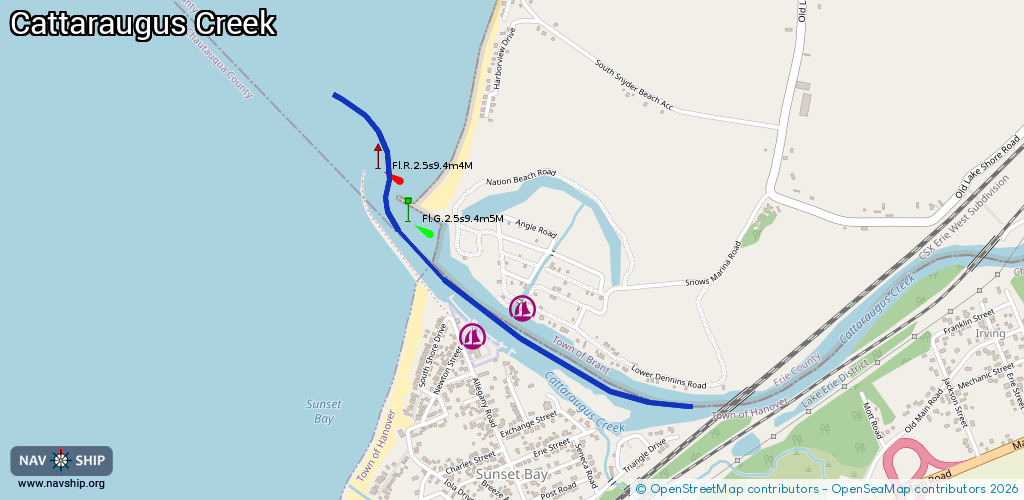
Route:
Please wait, loading route graphic...
Request waterway overview map with symbol legend here (Link).
Information about data associated with this body of water (4 available):
Data by OpenSeaMap (c) OSM contributors, www.openseamap.org
| # | Kind | Coordinates | Name | Information |
|---|---|---|---|---|
| 1 | Marina | 42.56751,-79.13482 | 2025-01-21T18:24:25Z | Sunset Bay State Marine Park +1 716-934-2375 https://parks.ny.gov/parks/sunsetbay/ |
| 2 | Marina | 42.56835,-79.1329 | 2025-01-13T16:30:14Z | Snows Marina Shop |
| 3 | Slipway | 42.56785,-79.13551 | small_craft_facility | 2015-10-06T15:10:28Z Keene Marine |
| 4 | Slipway | 42.56472,-79.13008 | small_craft_facility | 2015-10-06T15:10:28Z Pinzel's Island Marine |