Waterway information

Kind:
Inland
Driving areas:
🇺🇸 United States of America
Length:
66.4 km¹
¹River kilometers or bank length recorded in NavShip, including river arms and harbor entrances.
Availability:
Completely recorded
Recent Update: 26.03.2025²
² This date indicates when an adjustment last took place in the course of the body of water
Recorded:
Locks: 0
Harbours / marinas: 7
Bridges: 0
Berths: 0
Slipways: 2
Fuelstations: 0
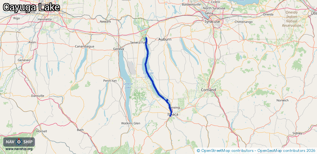
Route:
Please wait, loading route graphic...
Request waterway overview map with symbol legend here (Link).
Information about data associated with this body of water (9 available):
Data by OpenSeaMap (c) OSM contributors, www.openseamap.org
| # | Kind | Coordinates | Name | Information |
|---|---|---|---|---|
| 1 | Marina | 42.5355,-76.54652 | 2024-01-15T15:55:20Z | |
| 2 | Marina | 42.44513,-76.51215 | 2024-10-06T11:33:07Z | |
| 3 | Marina | 42.44348,-76.51183 | 2024-10-06T11:33:07Z | |
| 4 | Marina | 42.45189,-76.51022 | 2024-10-06T10:55:26Z | |
| 5 | Marina | 42.45852,-76.51473 | 2024-10-06T11:25:54Z | Allan H. Treman State Marine Park https://newyorkstateparks.reserveamerica.com/marina/allan-h-treman-state-marine-park/r/marinaDetails.do?contractCode=NY&parkId=3885 |
| 6 | Marina | 42.45898,-76.51411 | 2024-10-06T11:25:54Z | Allan H. Treman State Marine Park |
| 7 | Marina | 42.53619,-76.54838 | 2024-01-15T15:55:20Z | |
| 8 | Slipway | 42.5359,-76.54566 | Unknown | 2024-01-15T15:55:20Z |
| 9 | Slipway | 42.53638,-76.54835 | Unknown | 2025-05-01T14:37:52Z Myers Park Boat Launch |