Waterway information

Kind:
Inland
Driving areas:
🇺🇸 United States of America
Length:
15.1 km¹
¹River kilometers or bank length recorded in NavShip, including river arms and harbor entrances.
Availability:
Completely recorded
Recent Update: 06.06.2025²
² This date indicates when an adjustment last took place in the course of the body of water
Recorded:
Locks: 0
Harbours / marinas: 5
Bridges: 0
Berths: 0
Slipways: 0
Fuelstations: 0
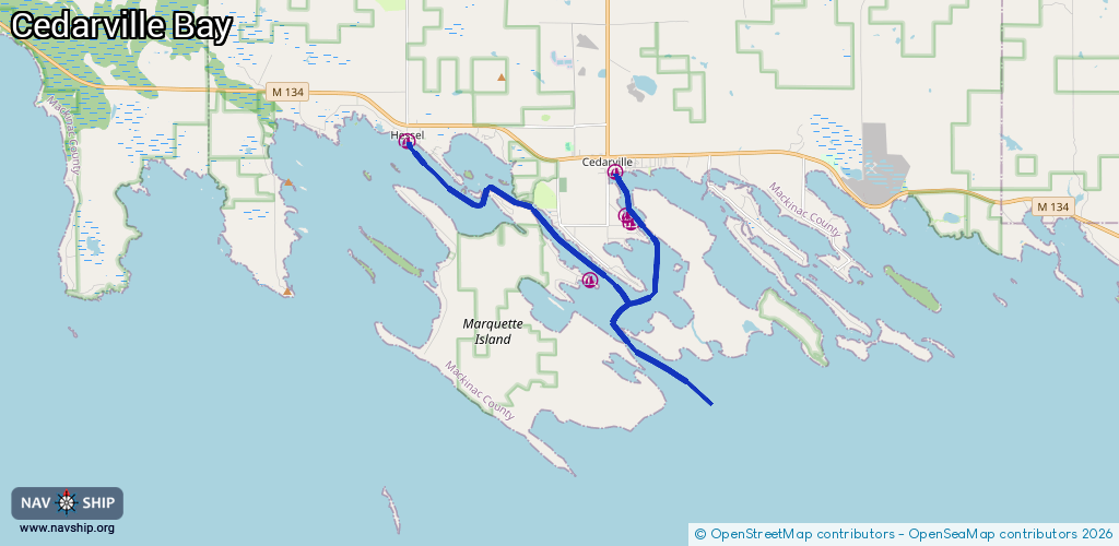
Route:
Please wait, loading route graphic...
Request waterway overview map with symbol legend here (Link).
Information about data associated with this body of water (5 available):
Data by OpenSeaMap (c) OSM contributors, www.openseamap.org
| # | Kind | Coordinates | Name | Information |
|---|---|---|---|---|
| 1 | Marina | 45.98501,-84.35563 | 2021-08-05T19:56:48Z | Viking Boat Harbor +1 906 484 3303 https://vikingboatharbor.com/ |
| 2 | Marina | 45.98656,-84.3571 | 2023-10-02T08:48:28Z | Tassier Boat Works +1 906 484 2573 https://tassierboatworks.com/ |
| 3 | Marina | 45.99607,-84.36053 | 2021-08-05T19:56:48Z | Cedarville Marine +1 906 484 2815 http://www.cedarvillemarine.com/ |
| 4 | Marina | 46.00277,-84.42602 | 2024-03-07T21:17:00Z | Hessel Marina |
| 5 | Marina | 45.97243,-84.36853 | 2025-04-01T16:20:33Z | Les Chenaux Yacht Club |