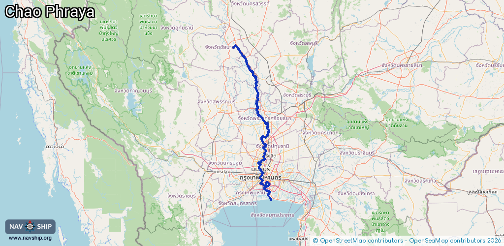
Waterway information

Kind:
Inland
Driving areas:
🌊 Pacific Ocean🇹🇭 Thailand
Length:
282.8 km¹
¹River kilometers or bank length recorded in NavShip, including river arms and harbor entrances.
Availability:
Completely recorded
Recent Update: 24.11.2025²
² This date indicates when an adjustment last took place in the course of the body of water
Recorded:
Locks: 0
Harbours / marinas: 7
Bridges: 0
Berths: 0
Slipways: 0
Fuelstations: 0
Route:
Please wait, loading route graphic...
Request waterway overview map with symbol legend here (Link).
Information about data associated with this body of water (7 available):
Data by OpenSeaMap (c) OSM contributors, www.openseamap.org
| # | Kind | Coordinates | Name | Information |
|---|---|---|---|---|
| 1 | Marina | 13.77439,100.50257 | 2025-07-29T05:37:58Z | ท่าวาสุกรี |
| 2 | Marina | 13.76163,100.48304 | 2022-10-12T16:48:52Z | https://images.mapillary.com/4CsNgn7DhUfFBAJ6Idk7dg/thumb-2048.jpg |
| 3 | Marina | 13.73861,100.51562 | 2023-06-16T09:49:32Z | ที่จอดเรือโดยสารคลองผดุงกรุงเกษม |
| 4 | Marina | 13.70218,100.49112 | 2025-12-29T05:41:16Z | ลานเรือสยามเจริญนคร |
| 5 | Marina | 13.67306,100.54599 | 2025-01-19T15:11:17Z | เจริญทองสุข |
| 6 | Marina | 13.65329,100.55628 | 2025-08-17T15:39:21Z | Thai Prosperity Terminal https://www.tptport.com/ |
| 7 | Marina | 13.58039,100.58895 | 2013-10-14T22:19:28Z |