Waterway information

Kind:
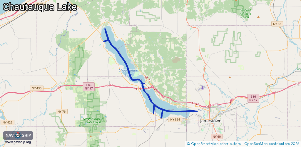
Inland
Driving areas:
🇺🇸 United States of America
Length:
31.9 km¹
¹River kilometers or bank length recorded in NavShip, including river arms and harbor entrances.
Availability:
Completely recorded
Recent Update: 01.04.2025²
² This date indicates when an adjustment last took place in the course of the body of water
Recorded:
Locks: 0
Harbours / marinas: 4
Bridges: 0
Berths: 0
Slipways: 0
Fuelstations: 0
Route:
Please wait, loading route graphic...
Request waterway overview map with symbol legend here (Link).
Information about data associated with this body of water (4 available):
Data by OpenSeaMap (c) OSM contributors, www.openseamap.org
| # | Kind | Coordinates | Name | Information |
|---|---|---|---|---|
| 1 | Marina | 42.23315,-79.4881 | 2025-01-02T02:07:19Z | Camp Merz - Waterfront |
| 2 | Marina | 42.10052,-79.35437 | 2021-07-10T15:18:30Z | Smith Boys Marina |
| 3 | Marina | 42.10827,-79.37169 | 2021-07-10T14:56:36Z | |
| 4 | Marina | 42.16034,-79.39311 | 2025-11-09T11:19:55Z | Bemus Bay Water Toys +1-716-490-5797 |