Waterway information

Kind:
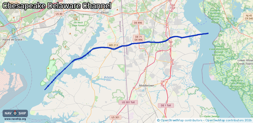
Inland
Driving areas:
🌊 Atlantic Ocean🇺🇸 United States of America
Length:
43.7 km¹
¹River kilometers or bank length recorded in NavShip, including river arms and harbor entrances.
Availability:
Completely recorded
Recent Update: 08.04.2025²
² This date indicates when an adjustment last took place in the course of the body of water
Recorded:
Locks: 0
Harbours / marinas: 4
Bridges: 0
Berths: 0
Slipways: 1
Fuelstations: 0
Route:
Please wait, loading route graphic...
Request waterway overview map with symbol legend here (Link).
Information about data associated with this body of water (5 available):
Data by OpenSeaMap (c) OSM contributors, www.openseamap.org
| # | Kind | Coordinates | Name | Information |
|---|---|---|---|---|
| 1 | Marina | 39.54671,-75.70678 | 2022-09-10T00:49:27Z | Summit North Marina |
| 2 | Marina | 39.52611,-75.81031 | 2021-11-19T00:46:08Z | Chesapeake Inn Marina Apr-Oct [email protected] +1 410 885 2040 https://www.chesapeakeinn.com/marina/ |
| 3 | Marina | 39.52659,-75.81141 | 2021-11-19T00:46:08Z | Chesapeake City Docks +1 410 656 1017 |
| 4 | Marina | 39.51327,-75.87595 | 2021-11-18T23:28:37Z | |
| 5 | Slipway | 39.54777,-75.7028 | Unknown | 2018-06-17T16:42:34Z |