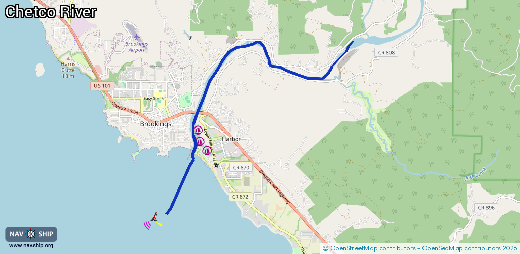
Waterway information

Kind:
Inland
Driving areas:
🌊 Pacific Ocean🇺🇸 United States of America
Length:
9.6 km¹
¹River kilometers or bank length recorded in NavShip, including river arms and harbor entrances.
Availability:
Completely recorded
Recent Update: 20.11.2023²
² This date indicates when an adjustment last took place in the course of the body of water
Recorded:
Locks: 0
Harbours / marinas: 3
Bridges: 0
Berths: 0
Slipways: 0
Fuelstations: 1
Route:
Please wait, loading route graphic...
Request waterway overview map with symbol legend here (Link).
Information about data associated with this body of water (4 available):
Data by OpenSeaMap (c) OSM contributors, www.openseamap.org
| # | Kind | Coordinates | Name | Information |
|---|---|---|---|---|
| 1 | Marina | 42.05067,-124.26876 | 2020-11-11T10:48:51Z | Port of Brookings Harbor Basin I |
| 2 | Marina | 42.04762,-124.26835 | 2024-06-27T17:53:30Z | Port of Brookings https://www.port-brookings-harbor.com/ |
| 3 | Marina | 42.04542,-124.2658 | 2020-11-11T10:48:51Z | Port of Brookings Harbor Basin II |
| 4 | Fuel station | 42.04762,-124.26759 | 2015-05-21T07:49:24Z |