Waterway information

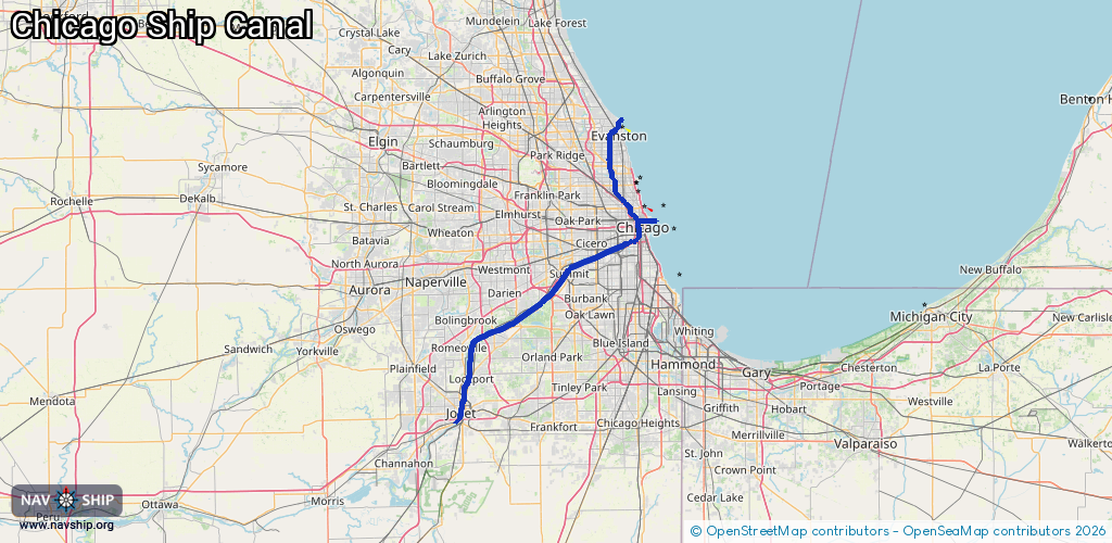
Kind:
Inland
Driving areas:
🇺🇸 United States of America
Length:
92.7 km¹
¹River kilometers or bank length recorded in NavShip, including river arms and harbor entrances.
Availability:
Completely recorded
Recent Update: 27.09.2024²
² This date indicates when an adjustment last took place in the course of the body of water
Recorded:
Locks: 2
Harbours / marinas: 8
Bridges: 2
Berths: 3
Slipways: 0
Fuelstations: 0
Route:
Please wait, loading route graphic...
Request waterway overview map with symbol legend here (Link).
Information about data associated with this body of water (15 available):
Data by OpenSeaMap (c) OSM contributors, www.openseamap.org
| # | Kind | Coordinates | Name | Information |
|---|---|---|---|---|
| 1 | Marina | 41.93735,-87.69096 | 2024-10-06T20:33:15Z | Rockwell Riverfront Marina |
| 2 | Marina | 41.9068,-87.65767 | 2024-09-23T01:55:43Z | |
| 3 | Marina | 41.88864,-87.59284 | 2023-07-09T12:51:18Z | Chicago Harbor |
| 4 | Marina | 41.89257,-87.60467 | 2025-07-24T19:37:16Z | Navy Pier Marina https://navypiermarina.com/ |
| 5 | Marina | 41.88784,-87.62896 | 2025-08-15T06:22:39Z | Marina City |
| 6 | Marina | 41.8872,-87.62875 | 2024-08-29T17:14:44Z | Downtown Docks https://www.downtowndocks.com/ |
| 7 | Marina | 41.8713,-87.63486 | 2025-04-03T18:12:38Z | River City Marina |
| 8 | Marina | 41.85479,-87.63793 | 2024-10-20T22:36:16Z | Canal Street Marina https://canalstreetmarina.com/ |
| 9 | Bridge | 41.88842,-87.60768 | Unknown | Clearance height: 2021-04-03T20:58:41Z m |
| 10 | Bridge | 41.88846,-87.60529 | Unknown | Clearance height: 2024-12-31T16:44:24Z m |
| 11 | Berth | 41.88891,-87.60584 | 2023-07-09T12:23:05Z | |
| 12 | Berth | 41.88806,-87.60423 | 2023-07-09T12:23:05Z | |
| 13 | Berth | 41.89947,-87.61341 | 2023-07-09T12:23:05Z | |
| 14 | Lock | 41.88844,-87.60612 | Unknown | |
| 15 | Lock | 41.56865,-88.07746 | Unknown |