Waterway information

Kind:
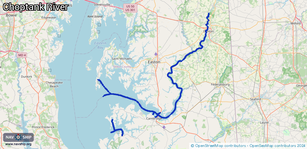
Inland
Driving areas:
🌊 Atlantic Ocean🇺🇸 United States of America
Length:
113.8 km¹
¹River kilometers or bank length recorded in NavShip, including river arms and harbor entrances.
Availability:
Completely recorded
Recent Update: 06.06.2025²
² This date indicates when an adjustment last took place in the course of the body of water
Recorded:
Locks: 0
Harbours / marinas: 5
Bridges: 7
Berths: 0
Slipways: 3
Fuelstations: 0
Route:
Please wait, loading route graphic...
Request waterway overview map with symbol legend here (Link).
Information about data associated with this body of water (15 available):
Data by OpenSeaMap (c) OSM contributors, www.openseamap.org
| # | Kind | Coordinates | Name | Information |
|---|---|---|---|---|
| 1 | Marina | 38.71277,-76.33456 | 2023-01-14T00:26:13Z | |
| 2 | Marina | 38.57692,-76.07215 | 2020-05-19T21:33:26Z | |
| 3 | Marina | 38.68112,-75.95065 | 2020-05-19T21:33:26Z | Choptank Marina |
| 4 | Marina | 38.59259,-76.04876 | 2021-10-24T08:05:39Z | |
| 5 | Marina | 38.55644,-76.27159 | 2020-05-19T21:33:26Z | |
| 6 | Bridge | 38.75666,-75.99623 | Unknown | Clearance height: 2024-08-20T20:00:46Z m Movable bridge (e.g. lifting bridge or drawbridge) fixed |
| 7 | Bridge | 38.75732,-75.9976 | Unknown | Clearance height: 2024-06-25T12:23:43Z m Maximum passage width: 50 m Movable bridge (e.g. lifting bridge or drawbridge) fixed |
| 8 | Bridge | 38.75678,-75.99677 | Unknown | Clearance height: 2024-06-25T12:23:43Z m Maximum passage width: 50 m Movable bridge (e.g. lifting bridge or drawbridge) fixed |
| 9 | Bridge | 38.75759,-75.99767 | Unknown | Clearance height: 2024-08-20T20:00:46Z m Movable bridge (e.g. lifting bridge or drawbridge) fixed |
| 10 | Bridge | 38.75719,-75.99705 | Unknown | Clearance height: 2024-08-20T20:00:46Z m Movable bridge (e.g. lifting bridge or drawbridge) swing |
| 11 | Bridge | 38.58315,-76.05412 | 60.9 | Clearance height: 2024-08-06T05:16:05Z m Maximum passage width: 15.2 m Movable bridge (e.g. lifting bridge or drawbridge) fixed |
| 12 | Bridge | 38.58319,-76.05421 | 60.9 | Clearance height: 2023-07-20T12:23:30Z m Maximum passage width: 15.2 m Movable bridge (e.g. lifting bridge or drawbridge) fixed |
| 13 | Slipway | 38.71284,-76.33427 | Unknown | 2023-01-14T00:26:13Z Dogwood Harbor Mo-Su 04:00-23:00 |
| 14 | Slipway | 38.50798,-76.22281 | Unknown | 2023-05-10T14:32:04Z |
| 15 | Slipway | 38.5563,-76.27206 | Unknown | 2019-12-16T04:37:11Z |