Waterway information

Kind:
Inland
Driving areas:
🌊 Atlantic Ocean🇬🇧 United Kingdom
Length:
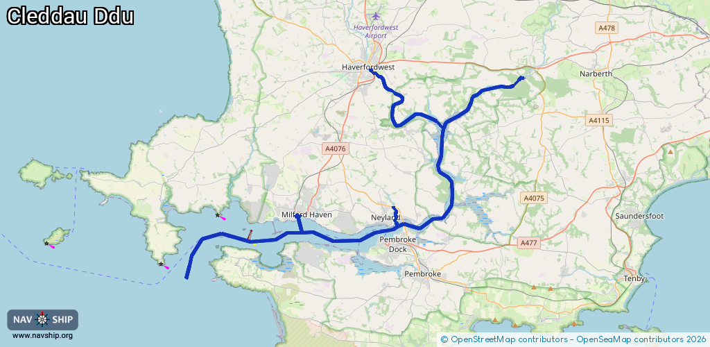
46.6 km¹
¹River kilometers or bank length recorded in NavShip, including river arms and harbor entrances.
Availability:
Completely recorded
Recent Update: 20.05.2025²
² This date indicates when an adjustment last took place in the course of the body of water
Recorded:
Locks: 1
Harbours / marinas: 4
Bridges: 0
Berths: 0
Slipways: 2
Fuelstations: 0
Route:
Please wait, loading route graphic...
Request waterway overview map with symbol legend here (Link).
Information about data associated with this body of water (6 available):
Data by OpenSeaMap (c) OSM contributors, www.openseamap.org
| # | Kind | Coordinates | Name | Information |
|---|---|---|---|---|
| 1 | Marina | 51.71099,-5.03767 | 2023-08-15T11:20:03Z | Milford Marina |
| 2 | Marina | 51.71382,-4.94247 | 2025-10-06T19:23:01Z | Neyland Yacht Haven - Upper Basin |
| 3 | Marina | 51.71027,-4.94234 | 2021-01-01T16:36:20Z | Neyland Yacht Haven - Lower Basin +44 1646 601601 https://www.yachthavens.com/neyland/ |
| 4 | Marina | 51.70476,-4.9709 | 2022-07-21T10:01:27Z | |
| 5 | Slipway | 51.69615,-4.94271 | small_craft_facility | 2024-11-16T23:13:21Z manually |
| 6 | Slipway | 51.68975,-5.07897 | small_craft_facility | 2023-05-25T14:14:00Z |
| 6 | Slipway | 51.68975,-5.07897 | small_craft_facility | 2023-05-25T14:14:00Z |