Waterway information

Kind:
Inland
Driving areas:
🇬🇧 United Kingdom
Length:
71.1 km¹
¹River kilometers or bank length recorded in NavShip, including river arms and harbor entrances.
Availability:
Completely recorded
Recent Update: 28.05.2025²
² This date indicates when an adjustment last took place in the course of the body of water
Recorded:
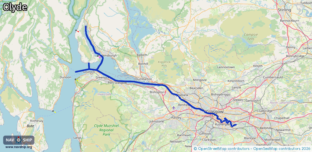
Locks: 0
Harbours / marinas: 5
Bridges: 0
Berths: 1
Slipways: 1
Fuelstations: 1
Route:
Please wait, loading route graphic...
Request waterway overview map with symbol legend here (Link).
Information about data associated with this body of water (8 available):
Data by OpenSeaMap (c) OSM contributors, www.openseamap.org
| # | Kind | Coordinates | Name | Information |
|---|---|---|---|---|
| 1 | Marina | 55.94343,-4.72615 | 2022-07-14T18:48:10Z | James Watt Dock Marina +44 1475 729 838 https://www.jameswattdockmarina.co.uk |
| 2 | Marina | 55.98412,-4.8196 | 2022-04-14T09:22:37Z | Kilcreggan Pier |
| 3 | Marina | 56.02722,-4.79317 | 2025-05-22T14:03:47Z | Blairvadach Sailing and Outdoor Centre |
| 4 | Marina | 56.01276,-4.79968 | 2022-04-19T19:05:21Z | Silvers Marine |
| 5 | Marina | 56.01286,-4.77345 | 2025-05-26T13:10:46Z | Rhu Marina |
| 6 | Slipway | 56.01278,-4.77354 | small_craft_facility | 2021-01-03T12:00:56Z |
| 7 | Berth | 56.0085,-4.76714 | 2019-03-09T17:35:01Z | Helensburgh Sailing Club mooring buoys small_craft_mooring |
| 8 | Fuel station | 55.94382,-4.72789 | 2025-04-27T12:32:29Z |