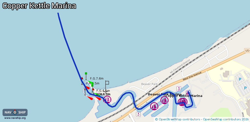
Waterway information

Kind:
Inland
Driving areas:
🇺🇸 United States of America
Length:
1.8 km¹
¹River kilometers or bank length recorded in NavShip, including river arms and harbor entrances.
Availability:
Completely recorded
Recent Update: 01.12.2023²
² This date indicates when an adjustment last took place in the course of the body of water
Recorded:
Locks: 0
Harbours / marinas: 5
Bridges: 0
Berths: 0
Slipways: 1
Fuelstations: 0
Route:
Please wait, loading route graphic...
Request waterway overview map with symbol legend here (Link).
Information about data associated with this body of water (6 available):
Data by OpenSeaMap (c) OSM contributors, www.openseamap.org
| # | Kind | Coordinates | Name | Information |
|---|---|---|---|---|
| 1 | Marina | 41.43667,-82.25095 | 2025-03-31T04:17:59Z | |
| 2 | Marina | 41.43602,-82.24677 | 2025-03-31T04:17:59Z | Beaver Park Marina |
| 3 | Marina | 41.43647,-82.24578 | 2015-10-08T08:30:09Z | Beaver Park Marina |
| 4 | Marina | 41.43636,-82.24412 | 2015-10-08T08:30:09Z | Copper Kettle Marina |
| 5 | Marina | 41.43635,-82.24442 | 2025-03-31T04:17:59Z | Copper Kettle Marina |
| 6 | Slipway | 41.43694,-82.24371 | small_craft_facility | 2015-10-08T08:30:10Z Ramp |