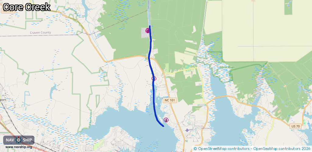
Waterway information

Kind:
Inland
Driving areas:
🌊 Atlantic Ocean🇺🇸 United States of America
Length:
10.8 km¹
¹River kilometers or bank length recorded in NavShip, including river arms and harbor entrances.
Availability:
Completely recorded
Recent Update: 16.11.2023²
² This date indicates when an adjustment last took place in the course of the body of water
Recorded:
Locks: 0
Harbours / marinas: 3
Bridges: 0
Berths: 0
Slipways: 0
Fuelstations: 0
Route:
Please wait, loading route graphic...
Request waterway overview map with symbol legend here (Link).
Information about data associated with this body of water (3 available):
Data by OpenSeaMap (c) OSM contributors, www.openseamap.org
| # | Kind | Coordinates | Name | Information |
|---|---|---|---|---|
| 1 | Marina | 34.85095,-76.692 | 2025-05-26T01:55:27Z | Seagate Marina |
| 2 | Marina | 34.85032,-76.69226 | 2025-04-02T20:16:35Z | Seagate |
| 3 | Marina | 34.80598,-76.68547 | 2022-10-04T14:53:07Z |