Waterway information

Kind:
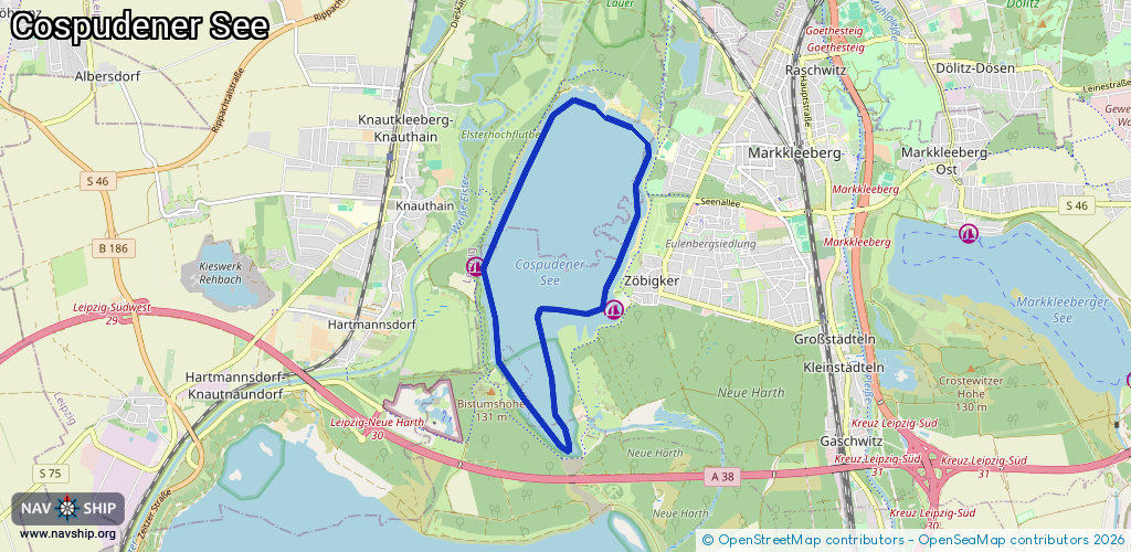
Lake
Driving areas:
🇩🇪 Germany
Length:
9.5 km¹
¹River kilometers or bank length recorded in NavShip, including river arms and harbor entrances.
Availability:
Completely recorded
Recent Update: 08.08.2023²
² This date indicates when an adjustment last took place in the course of the body of water
Recorded:
Locks: 0
Harbours / marinas: 2
Bridges: 0
Berths: 0
Slipways: 0
Fuelstations: 0
Route:
Please wait, loading route graphic...
Request waterway overview map with symbol legend here (Link).
Information about data associated with this body of water (2 available):
Data by OpenSeaMap (c) OSM contributors, www.openseamap.org
| # | Kind | Coordinates | Name | Information |
|---|---|---|---|---|
| 1 | Marina | 51.26341,12.34446 | 2023-07-31T08:09:38Z | Hafen Zöbigker Der Hafen ist überwiegend von Dauerliegern belegt. Gastliegeplätze sollten sich aber finden lassen. Auf dem See sind Motorboote sind nur mit Ausnahmegenehmigung zugelassen. Die Sanitäranlagen sind gut. Am Hafen gibt es Übernachtungsmöglichkeite |
| 2 | Marina | 51.26737,12.32211 | 2021-10-26T08:27:30Z | Hafen Seglerverein Leipzig Süd-West e.V. |