Waterway information

Kind:
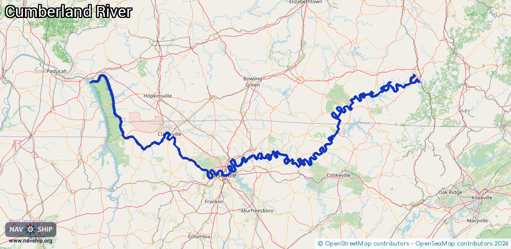
Inland
Driving areas:
🇺🇸 United States of America
Length:
780.9 km¹
¹River kilometers or bank length recorded in NavShip, including river arms and harbor entrances.
Availability:
Completely recorded
Recent Update: 17.10.2025²
² This date indicates when an adjustment last took place in the course of the body of water
Recorded:
Locks: 3
Harbours / marinas: 9
Bridges: 0
Berths: 2
Slipways: 0
Fuelstations: 1
Route:
Please wait, loading route graphic...
Request waterway overview map with symbol legend here (Link).
Information about data associated with this body of water (15 available):
Data by OpenSeaMap (c) OSM contributors, www.openseamap.org
| # | Kind | Coordinates | Name | Information |
|---|---|---|---|---|
| 1 | Marina | 36.98834,-84.92686 | 2022-10-06T02:20:32Z | Lake Cumberland Marina |
| 2 | Marina | 36.95317,-84.97296 | 2022-07-12T21:33:04Z | Wolf Creek Marina |
| 3 | Marina | 37.04686,-84.67234 | 2025-05-20T02:17:23Z | Lee's Ford Marina |
| 4 | Marina | 36.9545,-84.82749 | 2021-07-10T16:39:31Z | |
| 5 | Marina | 36.2979,-86.64527 | 2025-09-13T11:52:36Z | Anchor High Marina https://www.anchorhighmarina.net/ |
| 6 | Marina | 36.25599,-85.8014 | 2026-02-20T17:02:50Z | Wildwood Resort and Marina https://wildwoodresorttn.com/ |
| 7 | Marina | 36.30417,-85.90818 | 2021-11-25T17:20:10Z | DEFEATED CREEK MARINA |
| 8 | Marina | 36.33497,-86.42959 | 2023-12-22T19:58:26Z | Cherokee Marina & Campground https://cherokeemarina.com/ |
| 9 | Marina | 36.25497,-86.56631 | 2023-05-18T18:24:10Z | Harbor Island Yacht Club |
| 10 | Berth | 36.29385,-86.6568 | 2025-09-26T08:58:31Z | Iroquois |
| 11 | Berth | 36.29334,-86.65724 | 2025-09-26T08:58:31Z | Kenneth Eddy |
| 12 | Fuel station | 36.29731,-86.64566 | 2025-09-12T13:18:52Z | https://www.anchorhighmarina.net/our-shop |
| 13 | Lock | 36.29051,-85.94274 | Unknown | |
| 14 | Lock | 36.29573,-86.65655 | Unknown | |
| 15 | Lock | 36.32055,-87.22207 | Unknown |