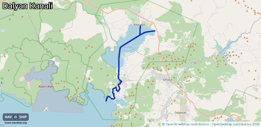
Waterway information

Kind:
Inland
Driving areas:
🌊 Sea Mediterranean🇹🇷 Turkey
Length:
31.6 km¹
¹River kilometers or bank length recorded in NavShip, including river arms and harbor entrances.
Availability:
Completely recorded
Recent Update: 08.04.2025²
² This date indicates when an adjustment last took place in the course of the body of water
Recorded:
Locks: 0
Harbours / marinas: 3
Bridges: 0
Berths: 0
Slipways: 0
Fuelstations: 0
Route:
Please wait, loading route graphic...
Request waterway overview map with symbol legend here (Link).
Information about data associated with this body of water (3 available):
Data by OpenSeaMap (c) OSM contributors, www.openseamap.org
| # | Kind | Coordinates | Name | Information |
|---|---|---|---|---|
| 1 | Marina | 36.83584,28.64146 | 2021-06-19T13:59:18Z | |
| 2 | Marina | 36.95605,28.68925 | 2024-10-19T15:03:32Z | |
| 3 | Marina | 36.95563,28.69379 | 2024-10-19T15:03:32Z |