Waterway information

Kind:
Lower
Driving areas:
🇷🇴 Romania
Length:
20 km¹
¹River kilometers or bank length recorded in NavShip, including river arms and harbor entrances.
Availability:
Completely recorded
Recent Update: 23.10.2025²
² This date indicates when an adjustment last took place in the course of the body of water
Recorded:
Locks: 0
Harbours / marinas: 6
Bridges: 0
Berths: 0
Slipways: 0
Fuelstations: 0
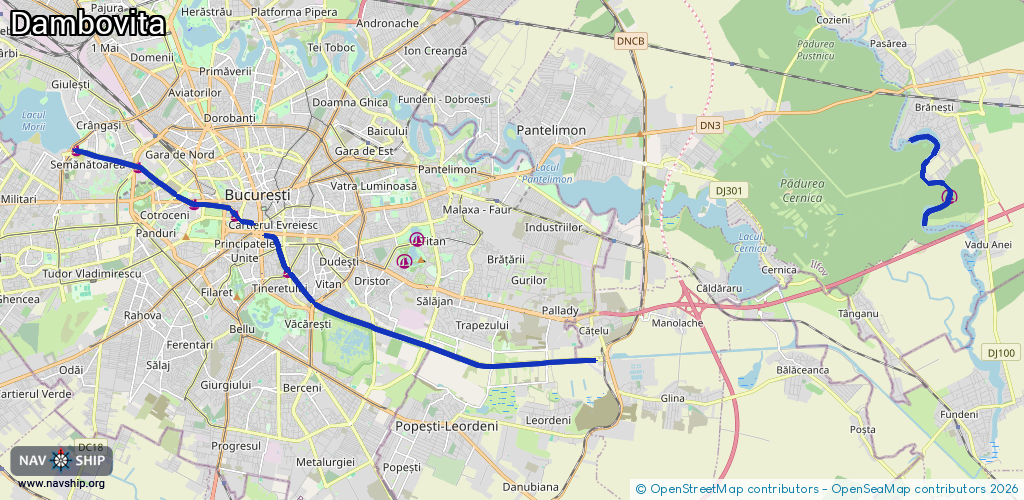
Route:
Please wait, loading route graphic...
Request waterway overview map with symbol legend here (Link).
Information about data associated with this body of water (6 available):
Data by OpenSeaMap (c) OSM contributors, www.openseamap.org
| # | Kind | Coordinates | Name | Information |
|---|---|---|---|---|
| 1 | Marina | 44.43118,26.09511 | 2025-08-16T07:53:53Z | Debarcader Națiunile Unite |
| 2 | Marina | 44.43397,26.0809 | 2025-08-19T18:33:57Z | Debarcader Operă |
| 3 | Marina | 44.44303,26.06172 | 2025-09-15T13:46:55Z | Debarcader |
| 4 | Marina | 44.44718,26.0405 | 2025-09-15T13:46:55Z | Debarcader |
| 5 | Marina | 44.41738,26.11306 | 2025-08-19T18:33:57Z | Debarcader Timpuri Noi |
| 6 | Marina | 44.43546,26.34023 | 2025-10-15T11:49:07Z |