Waterway information

Kind:
Inland
Driving areas:
🌊 Atlantic Ocean🇬🇧 United Kingdom
Length:
19.3 km¹
¹River kilometers or bank length recorded in NavShip, including river arms and harbor entrances.
Availability:
Completely recorded
Recent Update: 21.08.2023²
² This date indicates when an adjustment last took place in the course of the body of water
Recorded:
Locks: 0
Harbours / marinas: 4
Bridges: 0
Berths: 3
Slipways: 0
Fuelstations: 1
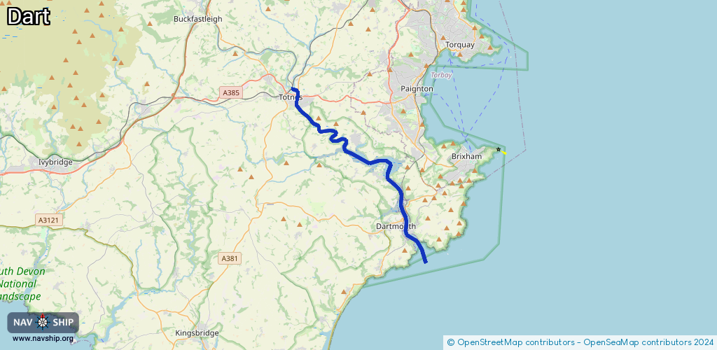
Route:
Please wait, loading route graphic...
Request waterway overview map with symbol legend here (Link).
Information about data associated with this body of water (8 available):
Data by OpenSeaMap (c) OSM contributors, www.openseamap.org
| # | Kind | Coordinates | Name | Information |
|---|---|---|---|---|
| 1 | Marina | 50.42923,-3.68169 | 2023-01-31T22:15:20Z | Totnes Marina |
| 2 | Marina | 50.4281,-3.68109 | 2023-01-31T22:15:20Z | Totnes Boat Yard |
| 3 | Marina | 50.35802,-3.57688 | 2015-03-06T22:43:48Z | Dart Marina |
| 4 | Marina | 50.35005,-3.57161 | 2023-07-25T20:55:14Z | Dart Haven Marina |
| 5 | Berth | 50.35547,-3.57245 | 2018-08-24T03:23:17Z | Kingswear Trots small_craft_mooring |
| 6 | Berth | 50.35555,-3.57621 | 2018-08-24T03:23:17Z | small_craft_mooring |
| 7 | Berth | 50.35129,-3.57424 | 2018-08-24T03:23:17Z | |
| 8 | Fuel station | 50.35417,-3.57396 | 2022-07-11T18:25:25Z | Dart Fuel Barge |