Waterway information

Kind:
Inland
Driving areas:
🇩🇪 Germany🇳🇱 Netherlands
Length:
1.7 km¹
¹River kilometers or bank length recorded in NavShip, including river arms and harbor entrances.
Availability:
Completely recorded
Recent Update: 25.01.2024²
² This date indicates when an adjustment last took place in the course of the body of water
Recorded:
Locks: 0
Harbours / marinas: 1
Bridges: 1
Berths: 0
Slipways: 1
Fuelstations: 1
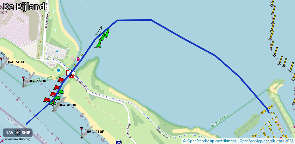
Route:
Please wait, loading route graphic...
Request waterway overview map with symbol legend here (Link).
Information about data associated with this body of water (4 available):
Data by OpenSeaMap (c) OSM contributors, www.openseamap.org
| # | Kind | Coordinates | Name | Information |
|---|---|---|---|---|
| 1 | Marina | 51.85819,6.09531 | 2023-05-30T19:04:55Z | Jachthaven de Bijland [email protected] +31 316 543 616 https://www.jachthavendebijland.nl |
| 2 | Bridge | 51.86212,6.08005 | Unknown | Clearance height: 2024-04-23T09:01:53Z m Maximum passage width: 19.70 m Movable bridge (e.g. lifting bridge or drawbridge) fixed |
| 3 | Slipway | 51.85963,6.09678 | small_craft_facility | 2020-03-20T14:42:39Z |
| 4 | Fuel station | 51.86271,6.08056 | 2022-06-06T09:03:37Z | Tankstation De Bijland Super,Diesel 10:00-18:00 +31 316 542 958 http://www.ts-debijland.nl |