Waterway information

Kind:
Inland
Driving areas:
🇺🇸 United States of America
Length:
5.2 km¹
¹River kilometers or bank length recorded in NavShip, including river arms and harbor entrances.
Availability:
Completely recorded
Recent Update: 30.01.2024²
² This date indicates when an adjustment last took place in the course of the body of water
Recorded:
Locks: 0
Harbours / marinas: 18
Bridges: 0
Berths: 0
Slipways: 0
Fuelstations: 0
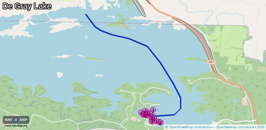
Route:
Please wait, loading route graphic...
Request waterway overview map with symbol legend here (Link).
Information about data associated with this body of water (18 available):
Data by OpenSeaMap (c) OSM contributors, www.openseamap.org
| # | Kind | Coordinates | Name | Information |
|---|---|---|---|---|
| 1 | Marina | 34.21549,-93.11356 | 2024-02-06T14:43:48Z | |
| 2 | Marina | 34.21934,-93.11875 | 2023-07-29T14:28:04Z | Iron Mountain Lodge & Marina |
| 3 | Marina | 34.21918,-93.11848 | 2023-07-29T14:28:04Z | |
| 4 | Marina | 34.2196,-93.12026 | 2023-07-29T14:28:04Z | |
| 5 | Marina | 34.21947,-93.12128 | 2023-07-29T14:28:04Z | |
| 6 | Marina | 34.21996,-93.12118 | 2023-07-29T14:28:04Z | |
| 7 | Marina | 34.22037,-93.12074 | 2023-07-29T14:28:04Z | |
| 8 | Marina | 34.22062,-93.12136 | 2023-07-29T14:28:04Z | |
| 9 | Marina | 34.22109,-93.12112 | 2023-07-29T14:28:04Z | |
| 10 | Marina | 34.22154,-93.12197 | 2023-07-29T14:28:04Z | |
| 11 | Marina | 34.22191,-93.12283 | 2023-07-29T14:28:04Z | |
| 12 | Marina | 34.22162,-93.12287 | 2023-07-29T14:28:04Z | |
| 13 | Marina | 34.22107,-93.12313 | 2023-07-29T14:28:04Z | |
| 14 | Marina | 34.22146,-93.12365 | 2023-07-29T14:28:04Z | |
| 15 | Marina | 34.22125,-93.12407 | 2023-07-29T14:28:04Z | |
| 16 | Marina | 34.22245,-93.12353 | 2023-07-29T14:28:04Z | |
| 17 | Marina | 34.22278,-93.12135 | 2023-07-29T14:28:04Z | |
| 18 | Marina | 34.22208,-93.12483 | 2023-07-29T14:28:04Z |