Waterway information

Kind:
Inland
Driving areas:
🇳🇱 Netherlands
Length:
4.4 km¹
¹River kilometers or bank length recorded in NavShip, including river arms and harbor entrances.
Availability:
Completely recorded
Recent Update: 20.12.2021²
² This date indicates when an adjustment last took place in the course of the body of water
Recorded:
Locks: 0
Harbours / marinas: 3
Bridges: 2
Berths: 1
Slipways: 0
Fuelstations: 0
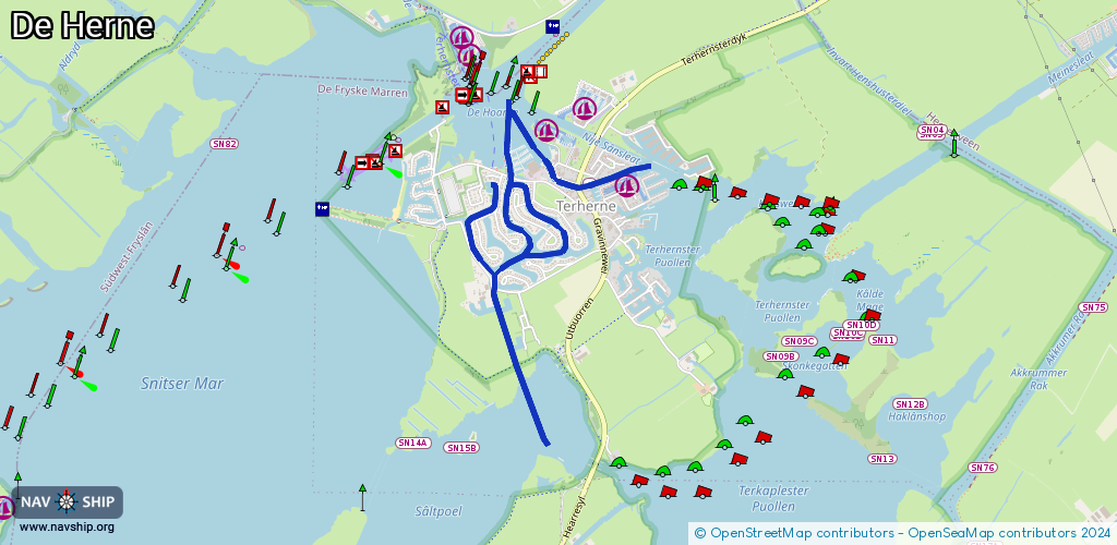
Route:
Please wait, loading route graphic...
Request waterway overview map with symbol legend here (Link).
Information about data associated with this body of water (6 available):
Data by OpenSeaMap (c) OSM contributors, www.openseamap.org
| # | Kind | Coordinates | Name | Information |
|---|---|---|---|---|
| 1 | Marina | 53.04154,5.78419 | 2025-04-14T15:12:20Z | Terherne Haven |
| 2 | Marina | 53.04402,5.77829 | 2025-08-10T13:45:54Z | De Schiffart Jachthaven |
| 3 | Marina | 53.04272,5.7757 | 2026-01-29T21:12:11Z | Marina de Horne [email protected] https://www.terhernenautic.nl/jachthaven/ |
| 4 | Bridge | 53.04195,5.77497 | 3 | Clearance height: 2025-03-23T19:41:39Z m Maximum passage width: 1.25 m Movable bridge (e.g. lifting bridge or drawbridge) fixed |
| 5 | Bridge | 53.03309,5.77539 | 4 | Clearance height: 2019-02-07T09:44:55Z m Maximum passage width: 1.1 m opening |
| 6 | Berth | 53.04168,5.78119 | 2020-09-27T18:38:39Z |