Waterway information

Kind:
Inland
Driving areas:
🇳🇱 Netherlands
Length:
8.2 km¹
¹River kilometers or bank length recorded in NavShip, including river arms and harbor entrances.
Availability:
Completely recorded
Recent Update: 24.07.2023²
² This date indicates when an adjustment last took place in the course of the body of water
Recorded:
Locks: 0
Harbours / marinas: 2
Bridges: 3
Berths: 0
Slipways: 0
Fuelstations: 0
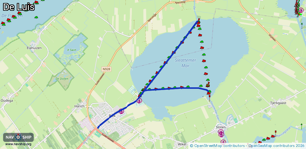
Route:
Please wait, loading route graphic...
Request waterway overview map with symbol legend here (Link).
Information about data associated with this body of water (5 available):
Data by OpenSeaMap (c) OSM contributors, www.openseamap.org
| # | Kind | Coordinates | Name | Information |
|---|---|---|---|---|
| 1 | Marina | 52.90407,5.59836 | 2021-08-26T19:33:51Z | Jachthaven Lutsmond https://www.jachthavenlutsmond.nl/ |
| 2 | Marina | 52.90042,5.58845 | 2024-08-06T19:58:32Z | Passantenhaven Balk |
| 3 | Bridge | 52.89906,5.58297 | Unknown | Clearance height: 2020-06-21T16:42:17Z m Movable bridge (e.g. lifting bridge or drawbridge) fixed |
| 4 | Bridge | 52.89798,5.5807 | Unknown | Clearance height: 2021-03-26T10:28:07Z m Movable bridge (e.g. lifting bridge or drawbridge) bascule |
| 5 | Bridge | 52.89686,5.57841 | Unknown | Clearance height: 2020-06-21T16:42:17Z m Movable bridge (e.g. lifting bridge or drawbridge) bascule |