Waterway information

Kind:
Inland
Driving areas:
🇳🇱 Netherlands
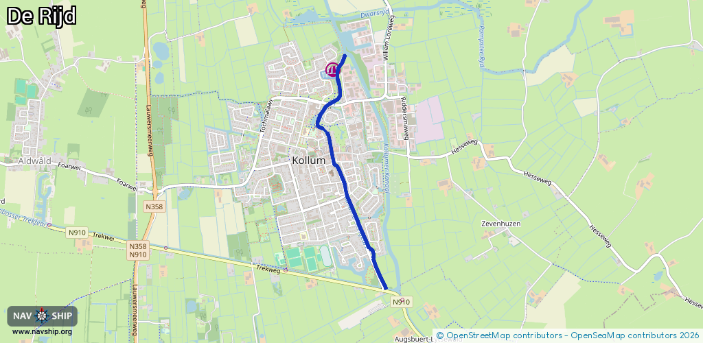
Length:
2.2 km¹
¹River kilometers or bank length recorded in NavShip, including river arms and harbor entrances.
Availability:
Completely recorded
Recent Update: 04.03.2025²
² This date indicates when an adjustment last took place in the course of the body of water
Recorded:
Locks: 0
Harbours / marinas: 1
Bridges: 7
Berths: 0
Slipways: 0
Fuelstations: 0
Route:
Please wait, loading route graphic...
Request waterway overview map with symbol legend here (Link).
Information about data associated with this body of water (8 available):
Data by OpenSeaMap (c) OSM contributors, www.openseamap.org
| # | Kind | Coordinates | Name | Information |
|---|---|---|---|---|
| 1 | Marina | 53.28664,6.15158 | 2025-09-14T21:16:47Z | Jachthaven de Rijd https://www.wsvkollum.nl |
| 2 | Bridge | 53.27295,6.15667 | Unknown | Clearance height: 2019-04-29T13:47:59Z m Maximum passage width: 2 m fixed |
| 3 | Bridge | 53.27717,6.15348 | Unknown | Clearance height: 2022-07-27T22:43:41Z m Maximum passage width: 2 m fixed |
| 4 | Bridge | 53.28036,6.15153 | Unknown | Clearance height: 2019-04-29T13:47:59Z m Maximum passage width: 2 m fixed |
| 5 | Bridge | 53.28169,6.15112 | Unknown | Clearance height: 2019-10-29T14:05:26Z m Maximum passage width: 2.5 m fixed |
| 6 | Bridge | 53.28244,6.14975 | Unknown | Clearance height: 2019-04-29T13:47:59Z m Maximum passage width: 3 m fixed |
| 7 | Bridge | 53.28402,6.15119 | Unknown | Clearance height: 2019-04-29T13:47:59Z m Maximum passage width: 3 m fixed |
| 8 | Bridge | 53.28485,6.15258 | 6 | Clearance height: 2019-04-29T13:47:59Z m Maximum passage width: 3 m fixed |