Waterway information

Kind:
Inland
Driving areas:
🇳🇱 Netherlands
Length:
7 km¹
¹River kilometers or bank length recorded in NavShip, including river arms and harbor entrances.
Availability:
Completely recorded
Recent Update: 26.09.2022²
² This date indicates when an adjustment last took place in the course of the body of water
Recorded:
Locks: 0
Harbours / marinas: 2
Bridges: 2
Berths: 0
Slipways: 0
Fuelstations: 2
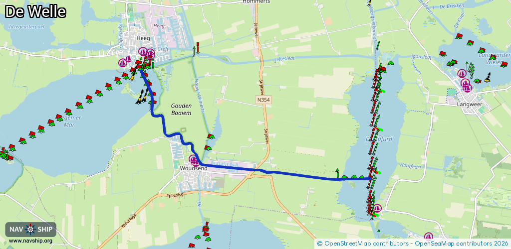
Route:
Please wait, loading route graphic...
Request waterway overview map with symbol legend here (Link).
Information about data associated with this body of water (6 available):
Data by OpenSeaMap (c) OSM contributors, www.openseamap.org
| # | Kind | Coordinates | Name | Information |
|---|---|---|---|---|
| 1 | Marina | 52.94549,5.62856 | 2023-07-10T19:07:21Z | Jachthafen de Rakken [email protected] +31 514 591 525 https://www.derakken.nl/de/ |
| 2 | Marina | 52.9452,5.62928 | 2023-07-10T19:07:21Z | Passantenhaven Wâldsein [email protected] +31 514 591 525 https://www.derakken.nl/de/ |
| 3 | Bridge | 52.94353,5.64903 | 7 | Clearance height: 2020-09-26T09:30:07Z m Maximum passage width: 2.4 m fixed |
| 4 | Bridge | 52.94373,5.64936 | 7 | Clearance height: 2020-09-26T09:30:07Z m Maximum passage width: 2.4 m fixed |
| 5 | Fuel station | 52.94347,5.64683 | 2025-02-13T20:59:53Z | Firezone +31 513 433 950 |
| 6 | Fuel station | 52.94477,5.6334 | 2016-04-03T22:42:30Z | Tankstation Benzin, Diesel |