Waterway information

Kind:
Lower
Driving areas:
🇳🇱 Netherlands🌊 North Sea
Length:
11.3 km¹
¹River kilometers or bank length recorded in NavShip, including river arms and harbor entrances.
Availability:
Completely recorded
Recent Update: 14.02.2023²
² This date indicates when an adjustment last took place in the course of the body of water
Recorded:
Locks: 0
Harbours / marinas: 0
Bridges: 9
Berths: 0
Slipways: 0
Fuelstations: 0
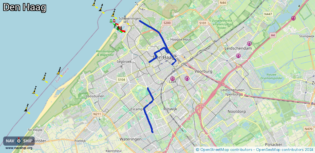
Route:
Please wait, loading route graphic...
Request waterway overview map with symbol legend here (Link).
Information about data associated with this body of water (9 available):
Data by OpenSeaMap (c) OSM contributors, www.openseamap.org
| # | Kind | Coordinates | Name | Information |
|---|---|---|---|---|
| 1 | Bridge | 52.04703,4.29354 | Unknown | Clearance height: 2021-03-18T09:10:04Z m fixed |
| 2 | Bridge | 52.05878,4.29352 | Unknown | Clearance height: 2021-03-17T21:04:09Z m fixed |
| 3 | Bridge | 52.07602,4.32239 | Unknown | Clearance height: 2020-08-08T18:31:39Z m Movable bridge (e.g. lifting bridge or drawbridge) fixed |
| 4 | Bridge | 52.08129,4.32033 | Unknown | Clearance height: 2020-08-08T18:31:39Z m Movable bridge (e.g. lifting bridge or drawbridge) fixed |
| 5 | Bridge | 52.08332,4.31786 | Unknown | Clearance height: 2018-08-28T16:03:45Z m |
| 6 | Bridge | 52.09481,4.30803 | Unknown | Clearance height: 2020-07-28T22:05:00Z m fixed |
| 7 | Bridge | 52.0839,4.30403 | Unknown | Clearance height: 2020-08-08T18:31:39Z m |
| 8 | Bridge | 52.08459,4.31434 | 3 | Clearance height: 2020-08-08T18:31:39Z m Maximum passage width: 1.5 m fixed |
| 9 | Bridge | 52.08362,4.31729 | 3 | Clearance height: 2020-08-08T18:31:39Z m Maximum passage width: 1.5 m fixed |