Waterway information

Kind:
Inland
Driving areas:
🇬🇧 United Kingdom
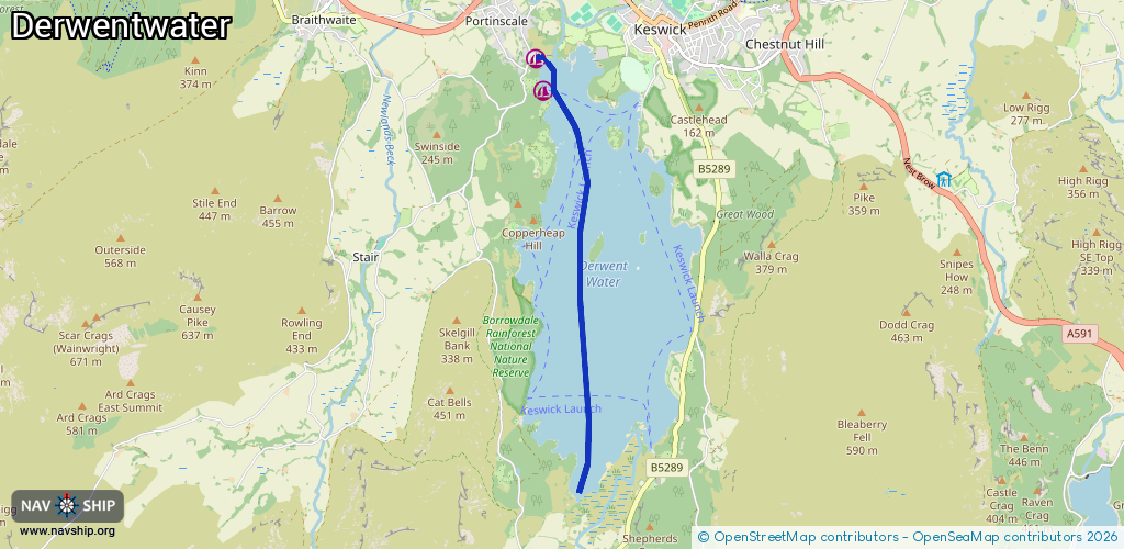
Length:
4.6 km¹
¹River kilometers or bank length recorded in NavShip, including river arms and harbor entrances.
Availability:
Completely recorded
Recent Update: 09.01.2024²
² This date indicates when an adjustment last took place in the course of the body of water
Recorded:
Locks: 0
Harbours / marinas: 2
Bridges: 0
Berths: 0
Slipways: 0
Fuelstations: 0
Route:
Please wait, loading route graphic...
Request waterway overview map with symbol legend here (Link).
Information about data associated with this body of water (2 available):
Data by OpenSeaMap (c) OSM contributors, www.openseamap.org
| # | Kind | Coordinates | Name | Information |
|---|---|---|---|---|
| 1 | Marina | 54.59544,-3.15606 | 2025-07-04T20:33:49Z | Nichol End Marine +44 17687 73082 https://nicholend.co.uk/ |
| 2 | Marina | 54.59841,-3.15732 | 2025-07-04T16:31:15Z | Derwentwater Marina +44 17687 72912 https://www.derwentwatermarina.co.uk/ |