Waterway information

Kind:
Inland
Driving areas:
🇭🇺 Hungary
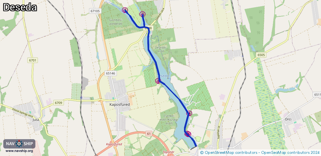
Length:
7.6 km¹
¹River kilometers or bank length recorded in NavShip, including river arms and harbor entrances.
Availability:
Completely recorded
Recent Update: 13.08.2023²
² This date indicates when an adjustment last took place in the course of the body of water
Recorded:
Locks: 0
Harbours / marinas: 6
Bridges: 0
Berths: 0
Slipways: 0
Fuelstations: 0
Route:
Please wait, loading route graphic...
Request waterway overview map with symbol legend here (Link).
Information about data associated with this body of water (6 available):
Data by OpenSeaMap (c) OSM contributors, www.openseamap.org
| # | Kind | Coordinates | Name | Information |
|---|---|---|---|---|
| 1 | Marina | 46.44589,17.79263 | 2022-05-16T18:33:48Z | |
| 2 | Marina | 46.44751,17.78302 | 2022-05-16T18:33:48Z | |
| 3 | Marina | 46.42062,17.8012 | 2022-05-16T18:33:48Z | |
| 4 | Marina | 46.40834,17.8182 | 2022-05-16T18:33:48Z | Vízisport-egyesület kajakkikötője |
| 5 | Marina | 46.40058,17.8172 | 2022-07-17T20:55:55Z | |
| 6 | Marina | 46.40039,17.8177 | 2022-05-16T18:33:48Z |