Waterway information

Kind:
Inland
Driving areas:
🇳🇱 Netherlands
Length:
2.3 km¹
¹River kilometers or bank length recorded in NavShip, including river arms and harbor entrances.
Availability:
Completely recorded
Recent Update: 01.09.2025²
² This date indicates when an adjustment last took place in the course of the body of water
Recorded:
Locks: 0
Harbours / marinas: 3
Bridges: 5
Berths: 0
Slipways: 0
Fuelstations: 0
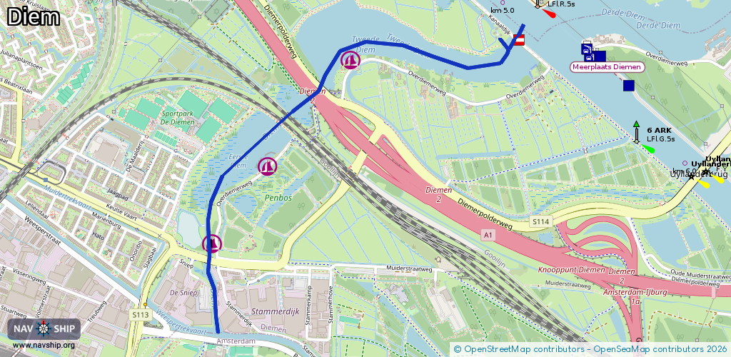
Route:
Please wait, loading route graphic...
Request waterway overview map with symbol legend here (Link).
Information about data associated with this body of water (8 available):
Data by OpenSeaMap (c) OSM contributors, www.openseamap.org
| # | Kind | Coordinates | Name | Information |
|---|---|---|---|---|
| 1 | Marina | 52.34077,4.98804 | 2022-06-23T05:41:50Z | |
| 2 | Marina | 52.33692,4.98306 | 2022-06-23T05:41:50Z | Jachthaven De Grote Zomer |
| 3 | Marina | 52.33408,4.97971 | 2022-06-23T05:41:50Z | |
| 4 | Bridge | 52.3397,4.98588 | Unknown | Clearance height: 2020-10-17T16:20:51Z m fixed |
| 5 | Bridge | 52.33882,4.98421 | Unknown | Clearance height: 2021-03-18T20:51:36Z m fixed |
| 6 | Bridge | 52.33862,4.98391 | Unknown | Clearance height: 2020-10-17T16:20:51Z m fixed |
| 7 | Bridge | 52.33353,4.97951 | Unknown | Clearance height: 2020-10-17T16:20:51Z m fixed |
| 8 | Bridge | 52.3416,4.99809 | 8.5 | Clearance height: 2021-09-12T20:20:06Z m Maximum passage width: 1.8 m fixed |