Waterway information

Kind:
Inland
Driving areas:
🇺🇸 United States of America
Length:
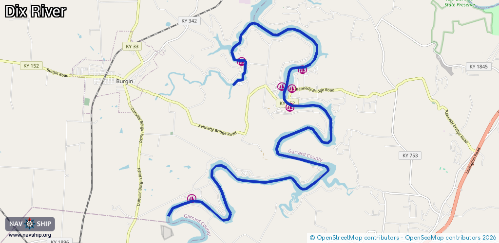
21.9 km¹
¹River kilometers or bank length recorded in NavShip, including river arms and harbor entrances.
Availability:
Completely recorded
Recent Update: 18.12.2023²
² This date indicates when an adjustment last took place in the course of the body of water
Recorded:
Locks: 0
Harbours / marinas: 6
Bridges: 0
Berths: 0
Slipways: 0
Fuelstations: 0
Route:
Please wait, loading route graphic...
Request waterway overview map with symbol legend here (Link).
Information about data associated with this body of water (6 available):
Data by OpenSeaMap (c) OSM contributors, www.openseamap.org
| # | Kind | Coordinates | Name | Information |
|---|---|---|---|---|
| 1 | Marina | 37.71937,-84.73746 | 2020-12-26T15:55:39Z | |
| 2 | Marina | 37.74489,-84.70288 | 2020-12-26T15:55:39Z | |
| 3 | Marina | 37.75072,-84.70569 | 2021-12-18T02:28:40Z | |
| 4 | Marina | 37.75014,-84.70217 | 2023-09-03T03:30:41Z | Kamp Kennedy Marina Th 11:00-19:00, Fr 11:00-21:00, Sa 08:00-21:00, Su 08:00-19:00, Mo-We off +1-859-548-2002 https://kampkennedymarina.com |
| 5 | Marina | 37.75544,-84.69844 | 2021-12-18T02:28:40Z | |
| 6 | Marina | 37.75769,-84.71989 | 2021-12-18T02:28:40Z |