Waterway information

Kind:
Inland
Driving areas:
🇳🇱 Netherlands
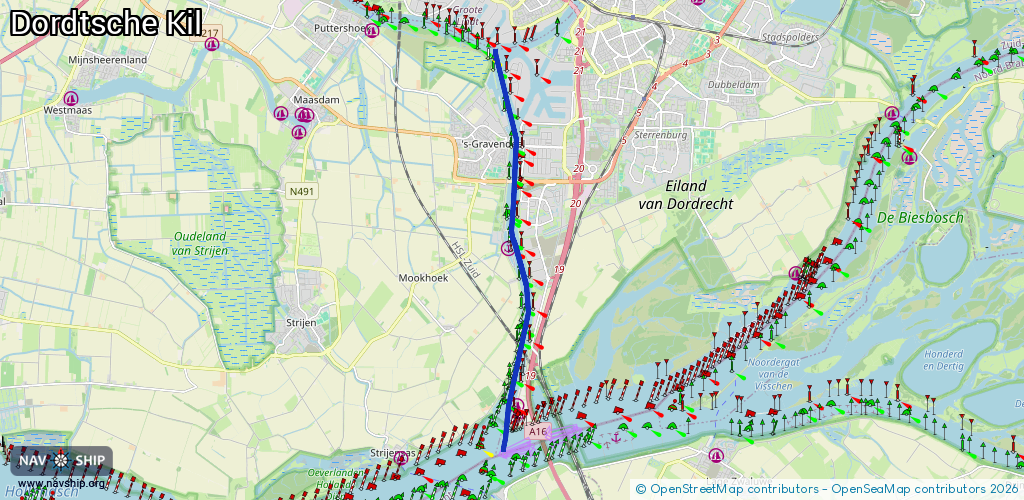
Length:
9.7 km¹
¹River kilometers or bank length recorded in NavShip, including river arms and harbor entrances.
Availability:
Completely recorded
Recent Update: 15.08.2023²
² This date indicates when an adjustment last took place in the course of the body of water
Recorded:
Locks: 0
Harbours / marinas: 3
Bridges: 0
Berths: 0
Slipways: 0
Fuelstations: 0
Route:
Please wait, loading route graphic...
Request waterway overview map with symbol legend here (Link).
Information about data associated with this body of water (3 available):
Data by OpenSeaMap (c) OSM contributors, www.openseamap.org
| # | Kind | Coordinates | Name | Information |
|---|---|---|---|---|
| 1 | Marina | 51.75806,4.62501 | 2020-02-21T19:35:15Z | De Wacht |
| 2 | Marina | 51.7249,4.62789 | 2025-03-09T00:29:03Z | W.S.V. “de Kil” https://www.wsvdekil.nl/ |
| 3 | Marina | 51.72297,4.62758 | 2023-08-09T00:12:18Z | Watersportvereniging De Kil [email protected] https://www.wsvdekil.nl/ |