Waterway information

Kind:
Inland
Driving areas:
🇬🇧 United Kingdom
Length:
18.4 km¹
¹River kilometers or bank length recorded in NavShip, including river arms and harbor entrances.
Availability:
Completely recorded
Recent Update: 07.02.2025²
² This date indicates when an adjustment last took place in the course of the body of water
Recorded:
Locks: 8
Harbours / marinas: 3
Bridges: 0
Berths: 0
Slipways: 0
Fuelstations: 0
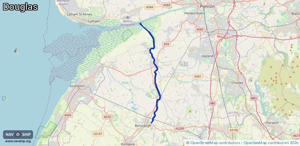
Route:
Please wait, loading route graphic...
Request waterway overview map with symbol legend here (Link).
Information about data associated with this body of water (3 available):
Data by OpenSeaMap (c) OSM contributors, www.openseamap.org
| # | Kind | Coordinates | Name | Information |
|---|---|---|---|---|
| 1 | Marina | 53.70129,-2.83102 | 2022-06-30T23:03:25Z | Douglas Marine Ltd. |
| 2 | Marina | 53.63382,-2.80985 | 2022-03-31T21:03:35Z | |
| 3 | Marina | 53.63365,-2.81123 | 2022-03-31T21:07:13Z | |
| 3 | Marina | 53.63365,-2.81123 | 2022-03-31T21:07:13Z | |
| 3 | Marina | 53.63365,-2.81123 | 2022-03-31T21:07:13Z | |
| 3 | Marina | 53.63365,-2.81123 | 2022-03-31T21:07:13Z | |
| 3 | Marina | 53.63365,-2.81123 | 2022-03-31T21:07:13Z | |
| 3 | Marina | 53.63365,-2.81123 | 2022-03-31T21:07:13Z | |
| 3 | Marina | 53.63365,-2.81123 | 2022-03-31T21:07:13Z | |
| 3 | Marina | 53.63365,-2.81123 | 2022-03-31T21:07:13Z | |
| 3 | Marina | 53.63365,-2.81123 | 2022-03-31T21:07:13Z |