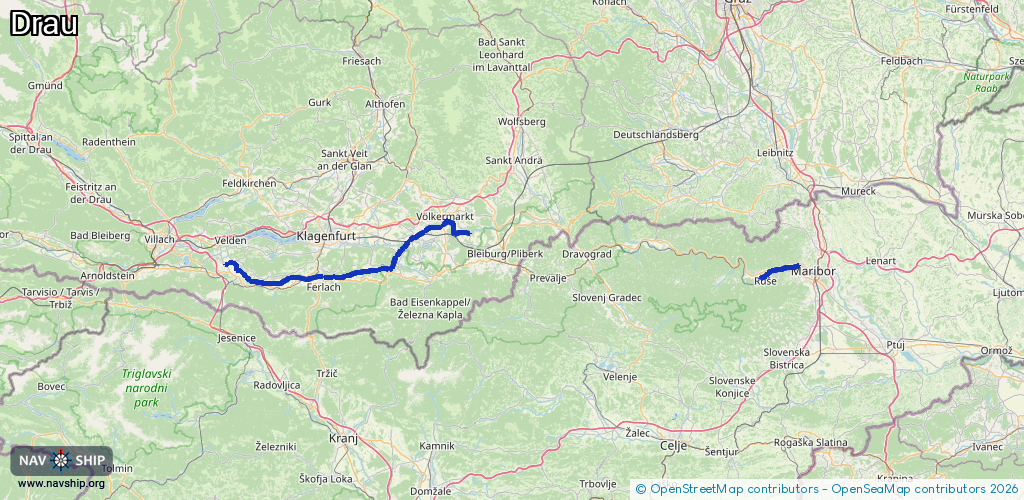
Waterway information

Kind:
Inland
Driving areas:
🇦🇹 Austria🇸🇮 Slovenia
Length:
70.9 km¹
¹River kilometers or bank length recorded in NavShip, including river arms and harbor entrances.
Availability:
Completely recorded
Recent Update: 29.07.2024²
² This date indicates when an adjustment last took place in the course of the body of water
Recorded:
Locks: 0
Harbours / marinas: 6
Bridges: 0
Berths: 0
Slipways: 2
Fuelstations: 0
Route:
Please wait, loading route graphic...
Request waterway overview map with symbol legend here (Link).
Information about data associated with this body of water (8 available):
Data by OpenSeaMap (c) OSM contributors, www.openseamap.org
| # | Kind | Coordinates | Name | Information |
|---|---|---|---|---|
| 1 | Marina | 46.54197,14.08998 | 2021-06-06T14:59:49Z | Dragositschach |
| 2 | Marina | 46.56425,15.59043 | 2020-10-01T19:54:50Z | |
| 3 | Marina | 46.54328,14.20468 | 2022-06-22T14:35:58Z | Bootshafen St. Johann |
| 4 | Marina | 46.65403,14.63348 | 2021-08-10T06:59:49Z | |
| 5 | Marina | 46.53374,14.13347 | 2017-02-08T07:29:15Z | |
| 6 | Marina | 46.53779,14.11023 | 2017-02-08T07:29:14Z | Sankt Oswald |
| 7 | Slipway | 46.54126,14.08971 | small_craft_facility | 2017-02-08T07:29:14Z |
| 8 | Slipway | 46.53686,14.11151 | small_craft_facility | 2017-02-08T07:29:14Z |