Waterway information

Kind:
Inland
Driving areas:
🇵🇱 Poland
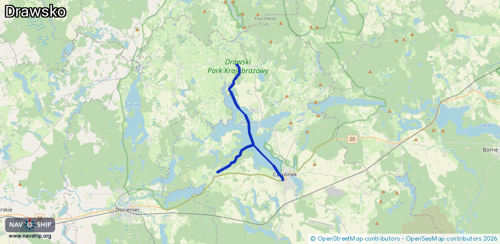
Length:
17.4 km¹
¹River kilometers or bank length recorded in NavShip, including river arms and harbor entrances.
Availability:
Completely recorded
Recent Update: 18.10.2023²
² This date indicates when an adjustment last took place in the course of the body of water
Recorded:
Locks: 0
Harbours / marinas: 1
Bridges: 0
Berths: 0
Slipways: 4
Fuelstations: 0
Route:
Please wait, loading route graphic...
Request waterway overview map with symbol legend here (Link).
Information about data associated with this body of water (5 available):
Data by OpenSeaMap (c) OSM contributors, www.openseamap.org
| # | Kind | Coordinates | Name | Information |
|---|---|---|---|---|
| 1 | Marina | 53.56085,16.22688 | 2024-08-08T23:07:49Z | Ośrodek Sportów Wodnych w Czaplinku +48 665 777 716, +48 94 375 55 76 |
| 2 | Slipway | 53.56214,16.13593 | small_craft_facility | 2023-11-11T22:28:17Z |
| 3 | Slipway | 53.55581,16.22959 | small_craft_facility | 2023-11-27T10:28:28Z |
| 4 | Slipway | 53.55884,16.22945 | small_craft_facility | 2021-08-22T10:18:32Z |
| 5 | Slipway | 53.56057,16.22653 | small_craft_facility | 2017-03-03T15:04:28Z |