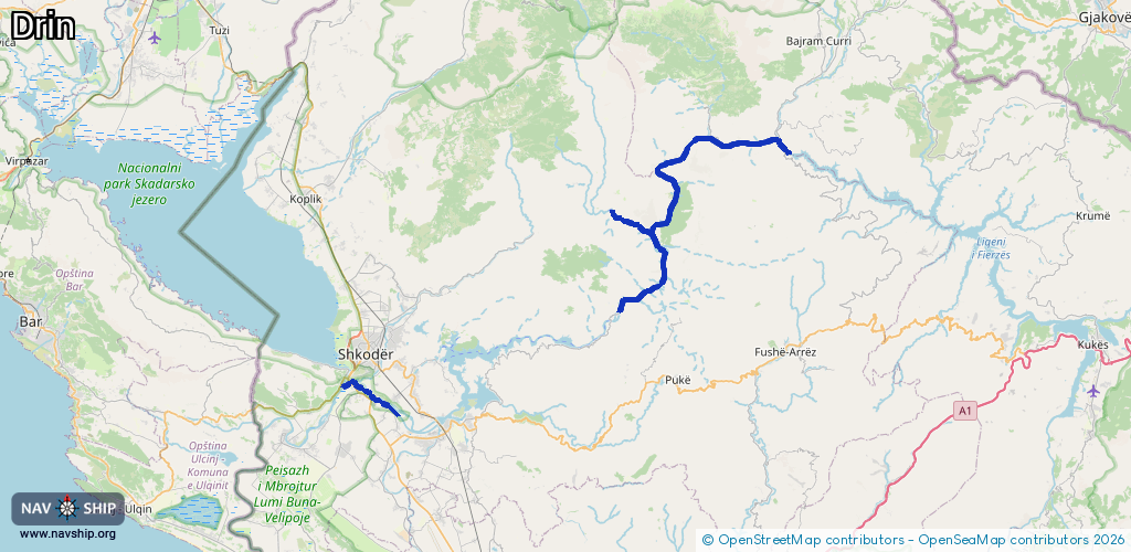
Waterway information

Kind:
Inland
Driving areas:
🇦🇱 Albania
Length:
49.1 km¹
¹River kilometers or bank length recorded in NavShip, including river arms and harbor entrances.
Availability:
Completely recorded
Recent Update: 26.03.2025²
² This date indicates when an adjustment last took place in the course of the body of water
Recorded:
Locks: 0
Harbours / marinas: 3
Bridges: 0
Berths: 0
Slipways: 0
Fuelstations: 0
Route:
Please wait, loading route graphic...
Request waterway overview map with symbol legend here (Link).
Information about data associated with this body of water (3 available):
Data by OpenSeaMap (c) OSM contributors, www.openseamap.org
| # | Kind | Coordinates | Name | Information |
|---|---|---|---|---|
| 1 | Marina | 42.26437,20.00981 | 2025-07-13T18:17:27Z | Terminali i Fierzës |
| 2 | Marina | 42.26403,20.00417 | 2023-04-19T14:51:56Z | Ferry Terminal Fierze - Koman |
| 3 | Marina | 42.10862,19.82629 | 2021-05-25T14:59:53Z | Terminali i Komanit |