Waterway information

Kind:
Lower
Driving areas:
🇳🇱 Netherlands
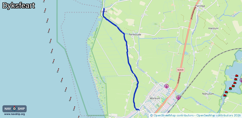
Length:
5.8 km¹
¹River kilometers or bank length recorded in NavShip, including river arms and harbor entrances.
Availability:
Completely recorded
Recent Update: 24.07.2023²
² This date indicates when an adjustment last took place in the course of the body of water
Recorded:
Locks: 0
Harbours / marinas: 0
Bridges: 3
Berths: 0
Slipways: 0
Fuelstations: 0
Route:
Please wait, loading route graphic...
Request waterway overview map with symbol legend here (Link).
Information about data associated with this body of water (3 available):
Data by OpenSeaMap (c) OSM contributors, www.openseamap.org
| # | Kind | Coordinates | Name | Information |
|---|---|---|---|---|
| 1 | Bridge | 53.00682,5.42242 | Unknown | Clearance height: 2021-05-25T23:38:37Z m fixed |
| 2 | Bridge | 53.00058,5.42598 | Unknown | Clearance height: 2021-05-25T23:38:37Z m fixed |
| 3 | Bridge | 52.97305,5.43421 | Unknown | Clearance height: 2021-05-25T23:38:37Z m fixed |